
by Dr Tertia Barnett and Dr Joana Valdez-Tullett
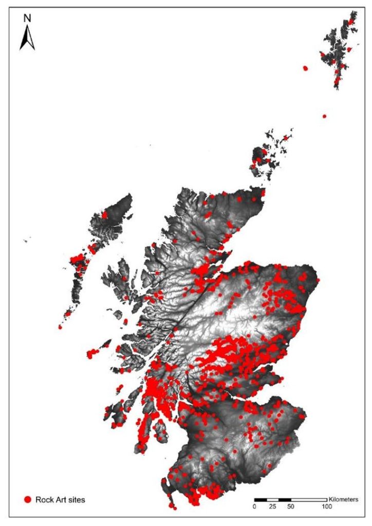
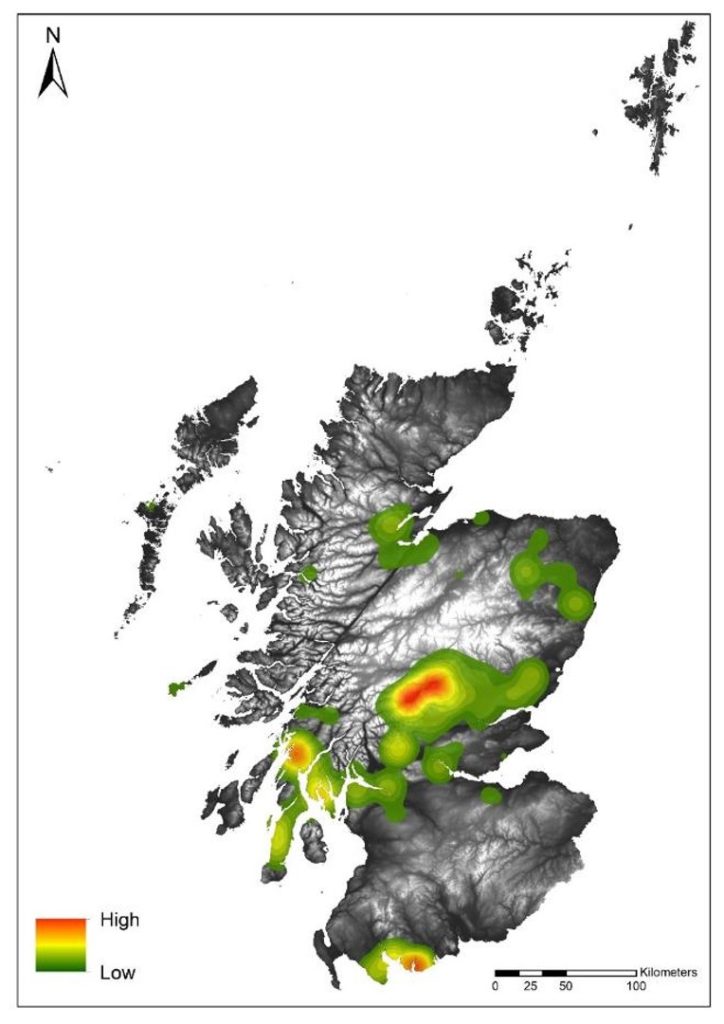
Prehistoric rock art in Scotland (often called cupmarks and cup and ring markings) is characterised by mainly circular geometric motifs carved into boulders and outcrops in the landscape. There are over 3,000 rock art ‘panels’ (carved rock surfaces) known in Scotland today, but these are not evenly distributed across the country. There are particularly high densities around Kilmartin in Argyll and Bute, around Kirkcudbright and the Machars peninsula in Dumfries and Galloway, and around Loch Tay and Strath Tay in Perth and Kinross. Smaller clusters are evident in parts of Angus, around the Cromarty and Beauly Firths in Highland, and in the islands of Bute and Tiree. Conversely, certain regions, including North West Highland and the Scottish Borders appear to have almost no rock art.
This raises questions about whether the distribution today reflects the spread of rock art in prehistory and, if so, what determines gaps and concentrations. Prehistoric distribution is crucial for understanding decision-making in the placement of the carvings within the landscape, and for contextualising rock art within the wider archaeological and palaeoenvironmental frameworks. The presence or absence of rock art can be affected by other factors which are unrelated to choices in prehistory, however. To avoid misleading interpretations, we need to understand the extent to which the current distribution is biased by patterns of survival, visibility, and discovery.
A large quantity of rock art has been destroyed over time through human activity. Quarrying, intensive agriculture, infrastructure development and urban construction have had a significant impact on rock art survival. Carvings are less prevalent in areas where these activities have been most concentrated. Traces of rock art documented around Edinburgh and Glasgow, for instance, hint at a far higher original concentration in these urban centres, while areas that have been intensively farmed for centuries, such as East Lothian, similarly offer tantalising glimpses of the scale of loss. Rock art is most likely to survive where land-use is less intensive, and this has given rise to the notion that carvings were preferentially created in upland areas of rough grazing and moorland, and around the fringes of fertile valleys. This pattern is accentuated in Highland Scotland where arable land is more restricted and more clearly defined by the mountainous terrain.
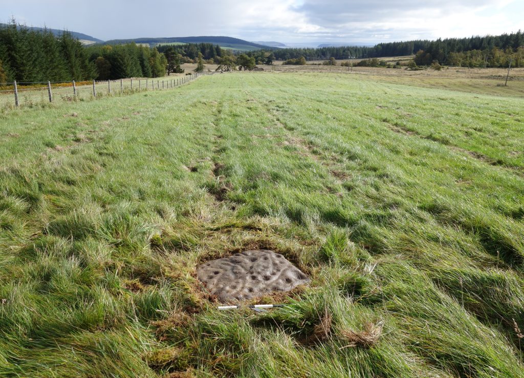
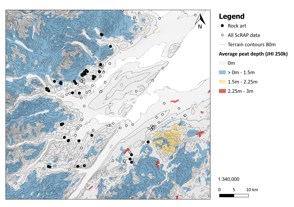
Rock art visibility is affected differentially by environmental, topographic and geological variables. Carvings exposed to prevailing winds and rain erode more quickly than those in sheltered locations. This impact is most pronounced on softer rock types, such as sandstone, and is accelerating with climate change. Erosion reduces the visibility of the carvings by making them increasingly shallow and difficult to identify. The nature of the panels (carved rocks) also has a significant bearing on their visibility. The motifs are typically carved on flat or gently sloping rock surfaces that are low-lying or flush with the ground. The panels can easily become overgrown by turf and vegetation, and it is likely that many remain concealed from view. Finally, peat growth since the early Neolithic has a geographically disproportionate effect on rock art visibility as low-lying panels are susceptible to being buried in areas with extensive peat deposition. This has been demonstrated in Highland region by Scotland’s Rock Art Project (ScRAP) research, which reveals a clear correlation between areas of high peat density and absence of rock art (Barnett et al 2024).
Gaps in rock art distribution may also reflect areas that have not been adequately surveyed. Historically, survey work has focussed on the South and West of Scotland, while large swathes in the North of Scotland received less attention (Barnett et al 2022). The work of North of Scotland Archaeological Society (NoSAS) in the Highland region during the Ross-shire Rock Art Project, and subsequently ScRAP, has re-shaped the rock art distribution map. Around 180 panels are now confirmed in the region, adding substantially to the earlier database (see HighARF section 5.6.4 Ritual and Special Places).
Areas where little rock art had been recorded previously, such as Tiree and the Cromarty Firth, are now known to have significant concentrations of carvings. Conversely, investigations during ScRAP in the Western Isles showed that many stones previously recorded as ‘cup-marked’ were in fact natural hollows or more recent historical features such as bait holes (circular depressions created by grinding shellfish to use as fish bait, and typically located on outcrops close to the sea).
The discovery by NoSAS of a cupmarked rock at Allt Nead in central Highland region during ScRAP, an area with virtually no other panels, highlights the importance of exploring places that appear to lack rock art. This discovery, which is located on a potential through-route between the East and West coasts, opens up new lines of enquiry about prehistoric connections across the country and research bias.
References
Barnett, T, Valdez-Tullett, J, Hoole, M, Jeffrey, S, Robin, G, Bjerketvedt, L M and Alexander, F 2022 ‘The Past, Present and Future of Rock Art Research in Scotland’, In Mazel, A and Nash, G (eds) Signalling and Performance: Ancient rock art in Britain and Ireland, Oxford: Archaeopress Archaeology, 10-66.
Barnett, T, Valdez-Tullett, T, Bjerketvedt, L M, Alexander-Reid, F, Hoole, M, Jeffrey, J and Robin, G 2024 ‘A multiscalar methodology for holistic analysis of prehistoric rock carvings in Scotland’, Heritage Science 12, 86. doi.org/10.1186/s40494-024-01183-8