
An extract from Ordnance Survey six inches to one mile scale, ‘County Series’ sheet 1.16, published 1856.
By the 1850’s Leith docks comprised three main dock basins and the outer harbour.

An extract from Ordnance Survey six inches to one mile scale, ‘County Series’ sheet 1.16, published 1920.
The 3rd edition of the Ordnance Survey map was published in 1920 and depicts some of the more subtle changes to the docks infrastructure support, such as the additional railway sidings to the north of Imperial Dock.
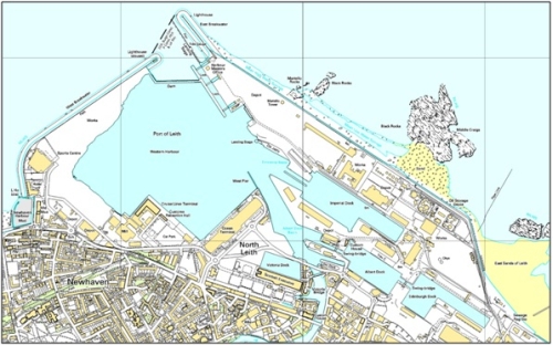
c.2005 Current Ordnance Survey 1:10 000
The 2005 Ordnance Survey map depicts the development of the docks system in a north-east direction, over Leith Sands (see Mowat, 1994 for further information). However, the major changes have been to the north-west with the creation of the western harbour. These changes may have resulted in the preservation of archaeological evidence, providing opportunities for the maritime past to be found and researched, © Ordnance Survey.
Return to Research based conservation of Harbours