
Ian Armit
Introduction
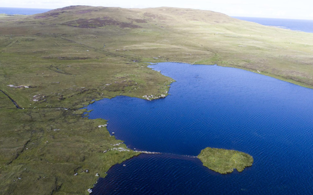
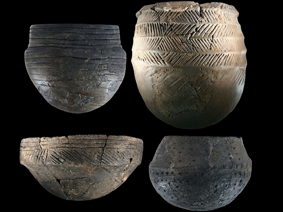
Eilean Dòmhnuill a’ Spionnaidh is an islet in Loch Olabhat, a small loch tucked into the remote northwest corner of North Uist in the Western Isles. Small-scale excavations by the antiquarian Erskine Beveridge, in the first decade of the 20th century, identified the site as an Iron Age ‘island dun’. Excavations from 1986-1992, however, as part of a wider programme of landscape survey and excavation, revealed a very different story. With virtually the first spade in the ground, numerous sherds of highly decorated Early Neolithic pottery began to appear, including highly distinctive Hebridean jars and Unstan bowls. Rather than a poorly preserved Iron Age settlement, Eilean Dòmhnuill turned out to be one of the most remarkable Neolithic sites in Scotland.
Not only was the entire islet found to be artificial (essentially a Neolithic crannog), comprised of the remains of superimposed buildings and midden deposits built up over many centuries, but the lower levels were found to be waterlogged, preserving a range of organic materials. Overall, this remarkable sequence of activity covered the period from around 3750 – 2800 BC; from the time of the first farmers in the Hebrides to the dramatic decline in settlement that we see over much of Britain during the Middle and Later Neolithic.
The site sequence
Although more than eleven distinct phases were identified during excavation, Neolithic activity at Eilean Dòmhnuill can be grouped into three main periods; Early, Middle and Late. Due to the waterlogging of the lower levels, it is the Early Period that is by far the best preserved, while deposits belonging to the Late Period were heavily disturbed during centuries of loch level fluctuations.
The Early Period
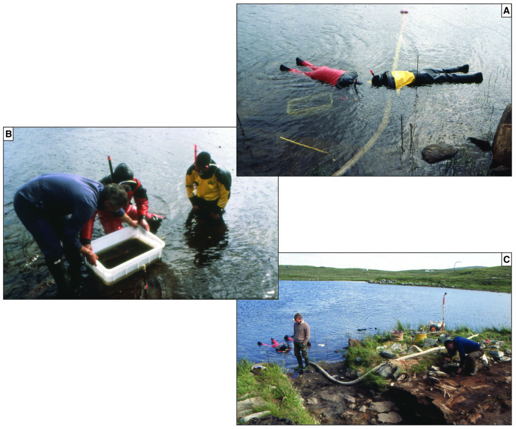
The earliest activity, dating to around 3750 BC is now entirely submerged and was investigated only partially, through underwater excavation in 1989 (Figure 2). This revealed the remains of wattle hurdles, timber posts, layers of brushwood, and deep organic floor layers. It also showed that, during its earliest phases, the islet had been considerably larger, extending at least two metres into the loch from its present perimeter. Given that the waterlogged deposits contained below the level of the excavation, it is possible that the origins of the site may lie in the earliest centuries of the fourth millennium BC, contemporary with the arrival of the first farming communities in the islands.
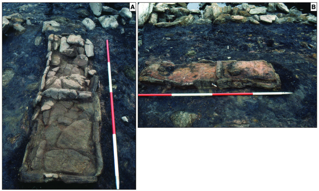
The lowest excavated levels on the islet itself also yielded organic remains, including wooden stakes, birch-bark tapers and fragments of rope. Excavation of these layers revealed a succession of buildings, of which only one appears to have occupied the islet at any given time. These were generally sub-rectangular, with stone-footings that probably supported turf walls. Each was dominated by an internal hearth, including a substantial 2m long kerbed, paved and subdivided example in Structure 8.1, and each structure seems to have been deliberately dismantled to make way for its successor. Large quantities of ash from the hearths accumulated both inside and outside the structures; indeed, the entire fabric of the islet as it appears above water is substantially comprised of the ash from these hearths and the collapsed walls of successive buildings.
The Middle Period
During the Middle Period, from around 3500–3000 BC, the same pattern of repeated construction and dismantling of buildings seems to have persisted. Now, however, it is clear that the islet was periodically inundated by the loch waters, leaving fine layers of lacustrine silt which survived in dips and hollows across the site. As a result, the deposits of this period are highly truncated, though the basic structural forms seem unchanged. Around 3000 BC, however, the fragmentary structures of the Middle Period were entirely sealed by a thin layer of lake sediment that can be traced across the whole islet. This period of submergence may have lasted a few years, or even decades, before the islet once again became accessible.
The Late Period
Eventually, the loch waters receded and there was a further period of activity culminating in the construction of two conjoined, sub-rectangular stone buildings. Virtually all the internal deposits associated with the Late Period buildings had been eroded away by subsequent fluctuating loch levels, making it hard to establish the chronology of this Late Period activity.
The continuing presence of distinctive Hebridean jars and Unstan bowls, however, and the total absence of Grooved Ware pottery, suggests that the site was finally abandoned before around 2800 BC.
The entrance works
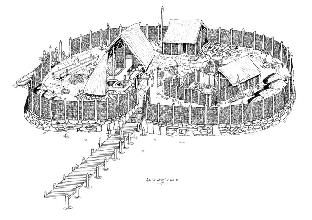
Throughout its occupation, Eilean Dòmhnuill was connected to the loch shore by a raised walkway that was remodelled on numerous occasions. During the Early and Middle Periods, this was built of wood, but during the Late Period, it was rebuilt in stone (a somewhat enhanced version of this stone causeway allows access to the islet today when water levels are low enough). During the earlier phases, the islet was entered through a stone-paved passageway lined with orthostats supporting a timber entrance façade that may have continued around the whole islet. Over time, this façade was replaced by a series of stone-footed ‘horn-works’. At all times, it appears that the interior of the islet was hidden from view.
Impact on the land
Paleoenvironmental analyses on pollen cores from the loch and sediments from the site itself have shown that the arrival of the first farming communities had a substantial impact on the local environment (Mills et al 2004). The light hazel and birch woodland cover present during the Mesolithic seems to have diminished rapidly during the 4th millennium BC, contemporary with the first appearance of cereal pollen. Heather and sphagnum moss also appear at this time, indicating of the onset of blanket peat.
Since timber was a precious resource, and the local peatlands remained little more than a thin cover, the main fuel at Eilean Dòmhnuill appears to have been turf, supplemented on occasion by dried animal dung. Stripping the land for turf would have led to serious problems of soil erosion that would have been further exacerbated by animal grazing. Indeed, the sediment core from Loch Olabhat shows a substantial run-off of sediments into the loch from around 3700–3500 BC. The problems of flooding seen throughout the site’s history seem to have been a direct result of this unsustainable pattern of land use.
A place apart
The nature of the Neolithic activity on Eilean Dòmhnuill is hard to interpret, but it was clearly not a simple domestic settlement. Beyond cooking and the grinding of grain (evidenced by stone saddle querns), there is little evidence for day-to-day domestic life. There is no sign of the earlier stages of cereal processing and, despite the preservation of organic material, no sign of wood-working waste. The shallow, finely stratified deposits have not been disturbed by trampling, suggesting that domestic animals were not kept on the islet. Similarly, analysis of beetle fauna suggests the absence of fresh dung, although dried dung appears to have been used for fuel. Most importantly, however, the instability the loch levels and frequent flooding, would have made Eilean Dòmhnuill a completely impractical place to live.
There are also intriguing similarities between Eilean Dòmhnuill and contemporary Hebridean passage tombs (Armit 2003). The narrow causeway and formalised entrance to the islet echo the constricted passages and stone facades of the tombs, creating a processional approach to both. Like the tombs, the interior of Eilean Dòmhnuill was closed and hidden. Both were places set apart from the every-day world.
What is perhaps most striking about Eilean Dòmhnuill, however, is its extraordinary duration and conservatism. People visited the islet for almost a millennium, yet the huge ceramic assemblage (> 22,000 sherds) shows no significant stylistic changes (Copper and Armit 2018; Figure 5). The size and form of the buildings also barely change, and there is no indication of any major change of use, despite innumerable episodes of flooding and at least one sustained period of complete submergence. Added to this, the site’s monumentality and isolation suggest a special place, perhaps restricted to a specific group (given the small size of the buildings) at a specific time of year. The liminal setting, between land and water, further reinforces this sense of Eilean Dòmhnuill as a place apart. Whatever it’s precise role, there is little question that Eilean Dòmhnuill played a central and enduring role in the lives of the first Hebridean farming communities.
Acknowledgements
Excavations at Eilean Dòmhnuill were funded by National Museums Scotland, Historic Environment Scotland and the Russell Trust.
References
Armit, I 2003 ‘The Drowners: permanence and transience in the Hebridean Neolithic’, in Armit, I, Murphy, E, Nelis, E and Simpson, D D A (eds) Neolithic settlement in Ireland and western Britain, Oxford, Oxbow, 93-100.
Copper, M and Armit, I 2018 ‘A conservative party? Pots and people in the Hebridean Neolithic’, Proceedings of the Prehistoric Society 84, 257-285.
Mills, C, Armit, I, Edwards, K Grinter, P and Mulder, Y 2004 ‘Neolithic land-use and environmental degradation: a study from the Western Isles of Scotland’, Antiquity 78, 88-95.