
Stephen J Dockrill
The excavation of Old Scatness (1995-2006) formed a focus of research examining settlement from the Early Iron Age until the early 20th century. The excavation revealed a substantial Iron Age village built around an early broch. The broch, which formed the focal point of the settlement, demonstrates a complex sequence of at least three main phases of use, the last of which aligns with the Pictish period. The site as a whole revealed an important development of Iron Age architecture from large roundhouse forms (suggestive of communal living) in the early and middle Iron Age towards smaller, cellular building forms (indicative of private space) in the later Iron Age or Pictish period.
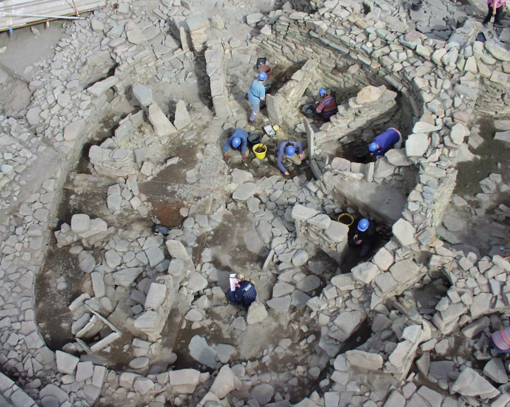
Old Scatness lies on the western coastline of Dunrossness, on the southern tip of Mainland Shetland. To the west is the Atlantic Ocean, and to the northeast, the Pool of Virkie and the North Sea. The underlying geology of Old Red Sandstone sedimentary sequence provides fertile soils as well as good building stone.
Old Scatness has resolved some of the chronological ambiguity for the Iron Age, Pictish and Viking periods (see Dockrill et al 2010 and Dockrill et al 2015). The broch at Old Scatness had been truncated on its northern circuit, allowing the investigation of the stratigraphic sequences predating and postdating the date of broch construction. The broch was found to be constructed between 390-200 BC. It represents one of the earliest complex roundhouses excavated so far that might be considered a full ‘broch’. The primary broch at Old Scatness is clearly associated with a stone-lined ditch which encloses the village which was constructed around the broch. This sequence of dates predating and postdating this construction event has been discussed fully by Dockrill (et al 2006).
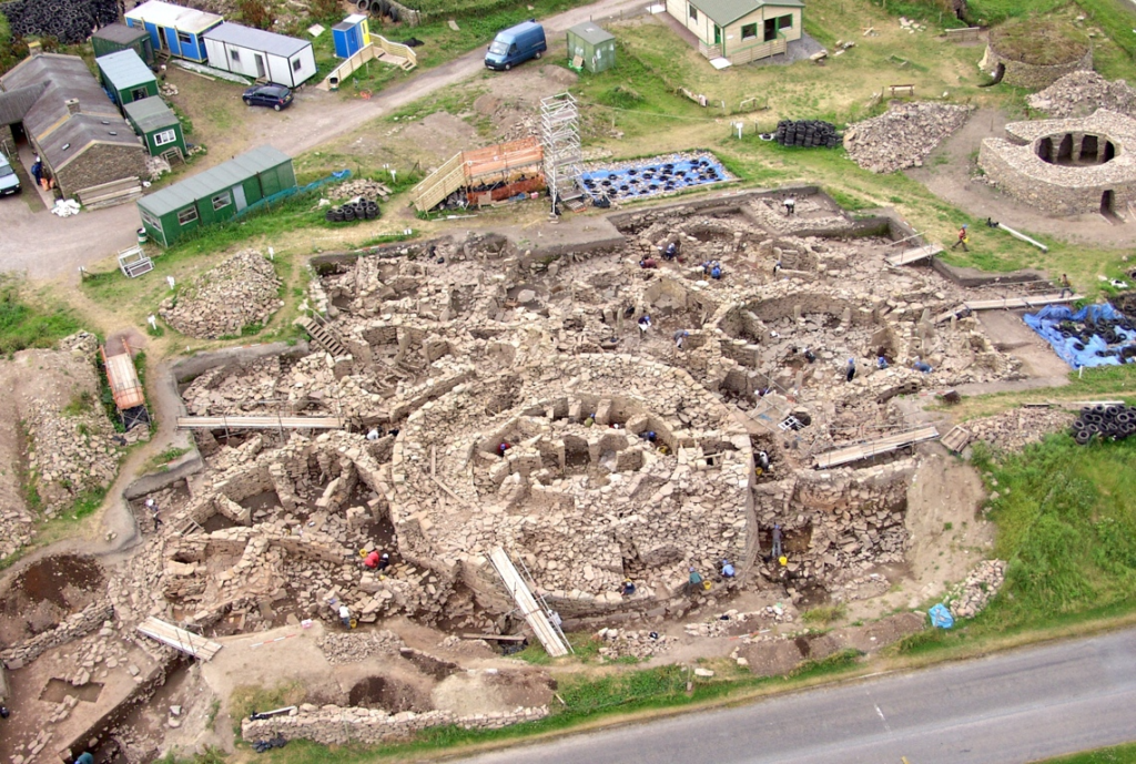
The structural development recorded in the settlement around the broch has enabled an understanding of Iron Age building forms and their development from aisled roundhouses to the wheelhouses of the later Iron Age seen at both Old Scatness and the adjacent settlement of Jarlshof.
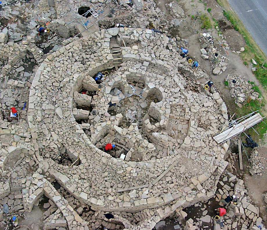
To the west of the broch were two large aisled roundhouses dating to the 1st century BC, each with ancillary buildings. These buildings demonstrated a complex history of use with evidence for an upper floor. This was probably a partial mezzanine level around the circumference of the buildings, resting on the piers. These structures provide architectural parallels to the wheelhouse forms found in the Western Isles. The buildings were later modified, with some of the aisled piers being infilled to form long, radial piers.
The site was reconfigured in the 1st century AD. The western wheelhouses were deliberately infilled and a radial wheelhouse was constructed within the broch tower. To the east of the broch, a large wheelhouse (Structure 21) was constructed. This large building was bisected by a medial wall paralleling the ‘aisled roundhouse’ at Jarlshof. A second smaller roundhouse (Structure 11) was also constructed to the southeast of the Broch; the stonework and date of initial occupation from the floor deposits indicate a date of construction in the 1st century AD.
These buildings were used within the first three centuries AD. It is significant that Structure 21 provided a much greater quantity of artefacts than the earlier roundhouses. Many of these artefacts were high status and included Roman glass fragments, amber and evidence of metalworking (mainly copper alloy). When viewed together, this assemblage provides clear evidence that is indicative of the continuation of a high-status settlement (Dockrill et al 2015, 492).
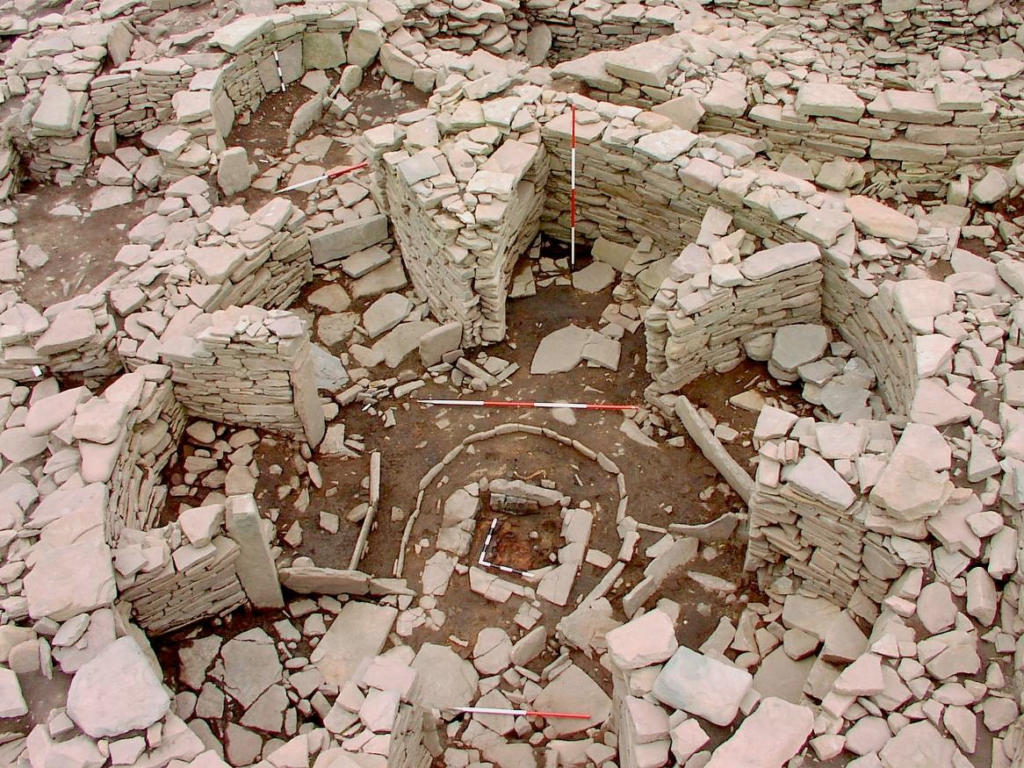
During the late Iron Age or Pictish phase at Old Scatness (AD 600-800), a variety of structural forms replaced the larger long-piered wheelhouse forms. These buildings included small, cellular structures to triangular piered wheelhouses, with parallels to Wheelhouse 2 and cellular buildings of this period at Jarlshof. This phase represents changes to the village that take place between the beginning of the 5th century AD and the arrival of Scandinavian people in the 9th-10th century. There is clear evidence for the later refurbishment of the broch with the internal area of the broch being sub-divided into cellular rooms (Structure 7) and connecting passage, the walls of which clearly butt the secondary reskinning of the inner broch wall. The presence of an in situ door lintel within Structure 7 indicated the impressive level of structural survival of this late phase within the standing broch. To the east of this structure, a multicellular semi-subterranean figure-of-8 structure (Structure 5) was connected by a corridor to Structure 7. A number of these cellular buildings had been inserted into earlier deposits, backed with rubble and midden, making them semi subterranean. The use of large tabular blocks set upright at the base of the structure and providing a foundation course for the inner dry-stone wall face forms another common architectural trait.
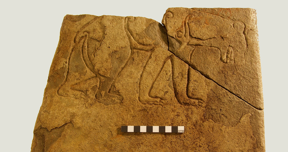
To the south of the broch, two wheelhouses (Structures 6 and 11) were connected by a corridor system. Structure 11 was constructed with secondary piers and contained a horseshoe-shaped hearth. On the floor of Structure 11, placed face downwards, was found a fine Class 1 Pictish carving of a brown bear.
Pier construction differed from the earlier aisled and long piers of the middle Iron Age, producing an architectural style that could be labelled ‘Pictish’. The sweeping curve formed by these cells and integral piers produces a distinct contrast to the earlier infilled aisled and rectangular piers, which project radially from the circular walls of the earlier wheel/roundhouses. Although a characteristic element of Pictish architecture, this curving pier is more probably a result of the simultaneous construction of the cell and wall than an intended design feature in itself. In Structure 11, the addition of large triangular piers to the walls of a pre-existing roundhouse provides yet another subtle variation in the finished design that owes its origin to no more than constructional necessity in reusing an existing building.
The artefactual evidence from the settlement at Old Scatness presents a narrative of wealth and status throughout the Iron Age, continuing through the Pictish period. In the early Iron Age, the nature of the bone deposition in the primary fill of the ditch indicated the raising of beef cattle and feasting. Later in the Iron Age there is further evidence of status in the form of imported Roman glass and evidence for metal working both with iron smithing and more importantly with the production of copper alloy objects (including hand pins and penannular brooches). The presence of the exceptionally well-carved Pictish class one symbol stone of the bear, in the secondary use of the roundhouse Structure 11 provides further evidence for status.
Evidence of agricultural wealth can be seen throughout this period. Of particular importance within the mixed economy was the cultivation of barley. The excavation of a purpose-built corn dryer in the later phase of the large Wheelhouse east of the broch (Structure 21) provides testament to the importance of this resource.
Evidence for the first Viking period activity was represented by the rapid infilling of several buildings with rubble and midden, including Structure 11. These infills contained classic soapstone vessel sherds and loomweights of Viking type. In the material filling the Structure 11 passageway was found a schist honestone, probably originating from Eidsborg, Norway.
Above this infilling of Structure 11, a surface with a distinctive long hearth form was found, with an archaeomagnetic date for last use between AD 850-960. The long hearth, some 2m in length, ran roughly north–south with a large flat stone, heavily burnt and fire-cracked at its southern end. Finds included soapstone (or steatite) vessel sherds, spindle whorls and a collection of over 40 soapstone and mica schist loomweights, 21 of which were found together as a group suggesting the location of a warp weighted loom. There was also an iron knife with a classic angle back typical of Viking knives. The area around the hearth was rich in the charred remains of flax, a crop which seems to have been introduced to the settlement at this time.
Truncated remains of post-medieval settlement indicates a decline in status, in addition to evidence for climate change and the incursions of windblown sand.
References
Dockrill S J, Bond, J M, Turner, V E, Brown, L D, Bashford, D J, Cussans, J E and Nicholson, R A 2010 Excavations at Old Scatness, Shetland Volume 1: The Pictish Village and Viking Settlement, Lerwick: Shetland Heritage Publications.
Dockrill S J, Bond, J M, Turner, V E, Brown, L D, Bashford, D J, Cussans, J E and Nicholson, R A (eds) 2015 Excavations at Old Scatness, Shetland, Volume 2: The Broch and Iron Age Village, Lerwick: Shetland Heritage Publications.
Dockrill, S J, Outram, Z and Batt, C M 2006 ‘Time and place: a new chronology for the origin of the broch based on the scientific dating programme at the Old Scatness Broch, Shetland’, Proceedings of the Society of Antiquaries of Scotland 136, 89-110.