
Stephanie Blankshein, Angela Gannon, Duncan Garrow and Fraser Sturt
Introduction
The Islands of Stone project ran from 2016-2025 and was funded by the Arts and Humanities Research Council, British Academy and Honor Frost Foundation. The primary purpose of this research project was to investigate Neolithic crannogs (or ‘archaeological islands’) in the Outer Hebrides and beyond. The core project was a collaborative one between the Universities of Southampton and Reading and Historic Environment Scotland.
Activities were also undertaken in collaboration with AOC Archaeology, Calanais Visitor Centre, the Western Isles Council Archaeology Service at Comhairle nan Eilean Siar, Highlands and Islands Airports Ltd, Museum nan Eilean (Lionacleit and Stornoway), National Museums Scotland, the Ordnance Survey, Uist Community Archaeology Group and the University of Bristol.
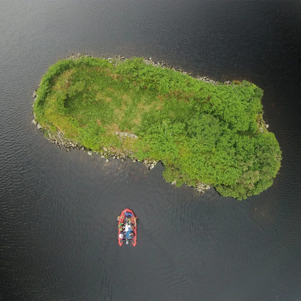
Crannogs are an evocative category of archaeological site. These artificial islands are widely dispersed geographically and chronologically – located across Scotland and Ireland and dated to anywhere between the Neolithic and post-medieval periods. 582 crannogs (and related site types) are recorded in Scotland, with the Outer Hebrides representing a particular hotspot in their distribution (Blankshein et al 2023a). The first artificial island identified as dating to the Neolithic period was Eilean Domhnuill, North Uist in the 1980s (Armit 2003). More recent diver surveys on the Isle of Lewis by Chris Murray and Mark Elliott identified five more sites associated with sometimes very substantial quantities of Neolithic material (Garrow and Sturt 2019). The Islands of Stone project was established in order to investigate these important and exciting sites in more detail.
A critical question that emerged through the project, locating it firmly in relation to the SIRFA theme of ‘connection and insularity’, was whether Neolithic crannogs are a phenomenon specific only to the Outer Hebrides. If so, they would represent a highly unusual example of insularity at that scale – we know from a range of other evidence that the islands certainly were connected materially and socially to the Scottish mainland and to other island groups including Orkney (Garrow and Sturt 2011). At the time of writing, the jury remains out on the possibility of Neolithic crannogs having existed beyond the Outer Hebrides, but there are hints of evidence that suggest they may be found more widely (Blankshein et al 2023a).
Desk-based research and fieldwork
The Islands of Stone project was comprised of a number of research elements:
Desk-based research into all ‘archaeological islands’ in Scotland
This work led to the first holistic, critically assessed record of these sites in Scotland, and associated enhancement of the Canmore (now Trove) dataset. The ‘archaeological islands’ database is available open access from the project’s ADS webpage (see Blankshein et al 2023a for more information).
Field survey visits to 114 crannogs in North Uist, Benbecula and South Uist
This work was carried out in order to assess the validity, broad character and potential for ‘early’ origins of these sites. Absolutely vital was our collaboration with the Uist Community Archaeology Group who undertook all of the site visits – a huge amount of work (Blankshein et al 2023b).
Diver survey of 30 sites in 25 lochs in North Uist, Benbecula and South Uist
This work was designed to recover dating evidence to help us to characterise these islets in more detail and potentially also to identify further Neolithic crannogs in the southern part of the island chain. We identified Neolithic pottery from three new sites and recovered dating evidence from ten additional sites (Blankshein et al 2023c).
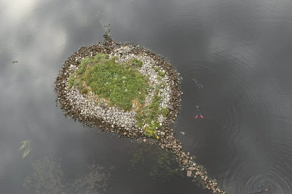
Walkover landscape survey of 10 artificial archaeological islands with Neolithic origins
This work was undertaken by the project’s HES team. Fieldwork involved a review of the positional accuracy and classification of all previously recorded sites in the national record as well as ground prospection for new sites. Results are available via Trove.
Excavation of one ‘showcase’ site at Loch Bhorgastail, Lewis
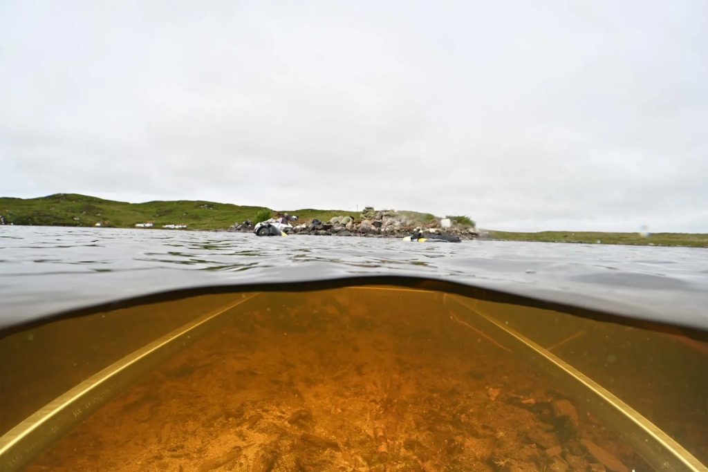
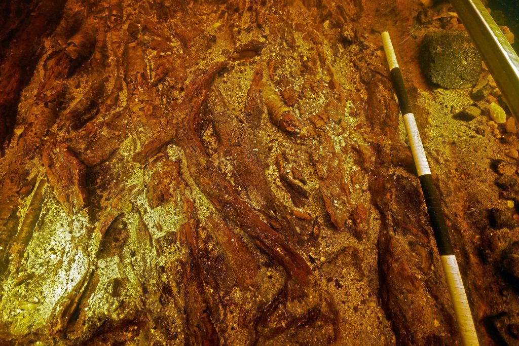
Importantly, this work included underwater and terrestrial excavation carried out together in combination (Blankshein et al 2022, 2024). Key findings included a very substantial Neolithic timber phase, pre-dating the now-visible stone islet, as well as a possible Middle Bronze Age pyre, cist burial and cairn. Post-excavation analysis is ongoing but will produce substantial specialist finds reports and a detailed radiocarbon chronology. We also undertook smaller scale investigations at the sites of Loch Langabhat and Loch Marabhat, Lewis.
Innovative methodologies
In addition to the core elements outlined above, the project also enabled us (along with colleagues) to explore a wide range of innovative methodologies:
Plant biomarker and lipid analysis
Our collaborators at the University of Bristol undertook a highly innovative study of plant biomarkers and lipids that were preserved within the fabric of pottery deposited within several lochs. This enabled them to understand different combinations of foodstuffs that had been cooked within the pots, including ‘the world’s oldest porridge’ as the popular press termed it (Hammann et al 2022).
Sedimentary DNA
Cores from the loch bed and islet at Loch Bhorgastail were sampled for sedimentary DNA. Crannogs represent phenomenal archives of environmental and archaeological data, and sedimentary DNA offers an additional and complimentary route to piecing together the story of human/environment interaction alongside more established techniques such as pollen and macrobotanical analysis.
Water penetrating radar
WPR surveys were undertaken at Loch Bhorgastail to map the submerged timber deposits around the island; the results were compared and contrasted with sub-bottom echo-sounder data. This survey identified timbers extending up to 10m from the edge of the stone island, confirming for the first time that WPR can find wood through shallow water.
Photogrammetry
Terrestrial photogrammetry was conducted using a drone (UAV) while underwater recording was carried out using a stereoscopic GoPro rig. By placing and recording survey markers on the islet, underwater and on the loch shore, the two types of photogrammetry survey could be merged into a single model. Orthomosaics (top-down 2D images), digital elevation models and 3D objects were created.
Beyond this fieldwork and related post-excavation elements, we also pioneered a number of innovative desk-based methods. These included:
Data mining and digital textual analysis
Much of the research for this project was predicated on an accurate database of Scottish ‘archaeological islands’. In order to generate the most comprehensive database of sites possible, in addition to the existing data provided by Canmore, an automated data mining process was used to identify all previous discussions of crannogs from antiquarian survey and excavation reports.
Artificial intelligence and machine learning
The identification of potential new crannog sites was made possible through use of machine learning. Aerial and satellite imagery was analysed using a Convolutional Neural Network to extract bodies of water, and islands within these. Our database of known crannogs was used as a training model for the computational processing, meaning that any newly-identified islands could then be given a confidence estimate as to their likelihood of being artificial. In total, 1,907 potential new islet sites were identified.
Collaboration and outreach
Collaboration with a wide range of partners was key to the project’s success and wider impact. Participation in the project by Chris Murray was central to its viability from the start. Our work with the Uist Community Archaeology Group, whose support for the project extended far beyond field survey alone, was also vital. Another key collaboration was with the Ordnance Survey, resulting in the development of two archaeological tours within their Secret Stories app. The first, Prehistory along the Hebridean Way, allows visitors to locate and discover high quality information about 22 prehistoric sites extending from southern Barra to the north of Lewis. The second tour is more specifically focused on the Calanais landscape, developed in collaboration with colleagues at the Calanais Visitor Centre.
During the life of the project, we were also very pleased to work with Benbecula and Stornoway airports, and with museum colleagues at Museum nan Eilean Lionacleit and Stornoway, to put on pop-up displays. A final collaboration that was extremely important to the project’s success was with Historic Environment Scotland. Alongside the direct involvement of Angela Gannon as a formal Co-Investigator, numerous colleagues across HES supported our work through engagement with and advice on its methodologies and wider thinking.
Summary
The Islands of Stone project was immensely fortunate in being able to investigate some of the most spectacular archaeology that the Outer Hebrides have to offer. With substantial funding behind us, we were able to undertake research into a range of elements, applying a wide array of different techniques. Crannogs are, in many senses, the ultimate insular phenomenon – artificial islands built within lochs in order to distance their occupants from the shore and perhaps also from other aspects of ‘everyday’ life. The sites we have excavated so far do not appear to have been occupied permanently but were likely visited occasionally, the activities carried out there involving food, drink and the deposition of many beautiful Neolithic pots into the water. As well as being insular, these Neolithic crannogs were, of course, also intimately connected to their local landscapes and to the wider word. In this way, then, they might be seen as a microcosm of the Outer Hebrides island chain itself, the only place – so far – where Neolithic islets have been found in Scotland. As we have discussed before (Garrow and Sturt 2017). As SIRFA clearly demonstrates, these island groups were also insular in some ways, yet highly connected in others.
References
Armit, I 2003 ‘The Drowners: permanence and transience in the Hebridean Neolithic’, in Armit, I, Murphy, E, Nelis, E and Simpson, D (eds) Neolithic Settlement in Ireland and Western Britain, Oxford: Oxbow Books, 93-100.
Blankshein, S, Garrow, D and Sturt. F 2022 Excavation and survey at Loch Bhorgastail, Isle of Lewis, Outer Hebrides (July 2021): Interim Report. https://doi.org/10.5284/1100101
Blankshein, S, Gannon, A, Garrow. D and Sturt, F 2023a ‘Neolithic crannogs in the Outer Hebrides (and beyond?): synthesis, survey and dating’, Proceedings of the Prehistoric Society 89. https://doi.org/10.1017/ppr.2023.10
Blankshein, S, Auger, R, Davies, S, Dix, J, Garrow, D, Karamitrou, A, Macleod, C, Monk, A, Newman, D, Rafferty, D, Stewart, M, Sturt, F and Wilson, A 2023b Uist Crannog Survey Part 1: Desk-based assessment and preliminary site visits, 2020-22 (July 2022). https://doi.org/10.5284/1100101
Blankshein, S, Gannon, A, Garrow, D, and Sturt, F 2023c Uist Crannog Survey Part 2: Underwater and detailed landscape survey (July 2022). https://doi.org/10.5284/1100101
Blankshein, S, Garrow, D and Sturt, F 2024 Excavation and survey at Loch Bhorgastail, Isle of Lewis, Outer Hebrides (July 2023): Interim report. https://doi.org/10.5284/1100101
Garrow, D and Sturt, F 2017 Neolithic Stepping Stones: Excavation and survey within the western seaways of Britain, 2008-2014. Oxford: Oxbow.
Garrow, D and Sturt, F 2019 ‘Neolithic crannogs: rethinking settlement, monumentality and deposition in the Outer Hebrides and beyond’, Antiquity 93, 664-684. https://doi.org/10.15184/aqy.2019.41
Garrow, D and Sturt, F 2011 ‘Grey waters bright with Neolithic argonauts? Maritime connections and the Mesolithic-Neolithic transition within the ‘western seaways’ of Britain, c. 5000-3500 BC’, Antiquity 85, 59-72. https://doi.org/10.1017/S0003598X00067430
Hammann, S, Bishop, R, Copper, M, Garrow, D, Greenwood, C, Hewson, L, Sheridan, J A, Sturt, F, Whelton, H and Cramp, L 2022 ‘Neolithic culinary traditions revealed by cereal, milk and meat lipids in pottery from Scottish crannogs’, Nature Communications 13, 5045. https://doi.org/10.1038/s41467-022-32286-0