More than 2000 sites across the Outer Hebrides are clearly identifiable as post-medieval. This is more than three times as many sites as all the other archaeological periods combined. Moreover, this is likely to be a gross underestimate of the true extent of the post-medieval archaeological dataset. Certainly, many post-medieval sites across the Outer Hebrides still remain unrecorded, with further unidentified sites of this period amongst the huge number of known, but currently undated, archaeological features. Despite this sizable dataset, very few archaeological research projects or research excavations have specifically targeted post-medieval sites or remains across the region. This is the case across most of Scotland but is arguably a heightened scenario for the Outer Hebrides. Parts of South Uist and Barra’s post-medieval landscapes have been fairly comprehensively recorded as part of the SEARCH project in the 1990s and 2000s (Branigan 2004, Parker Pearson 2010).
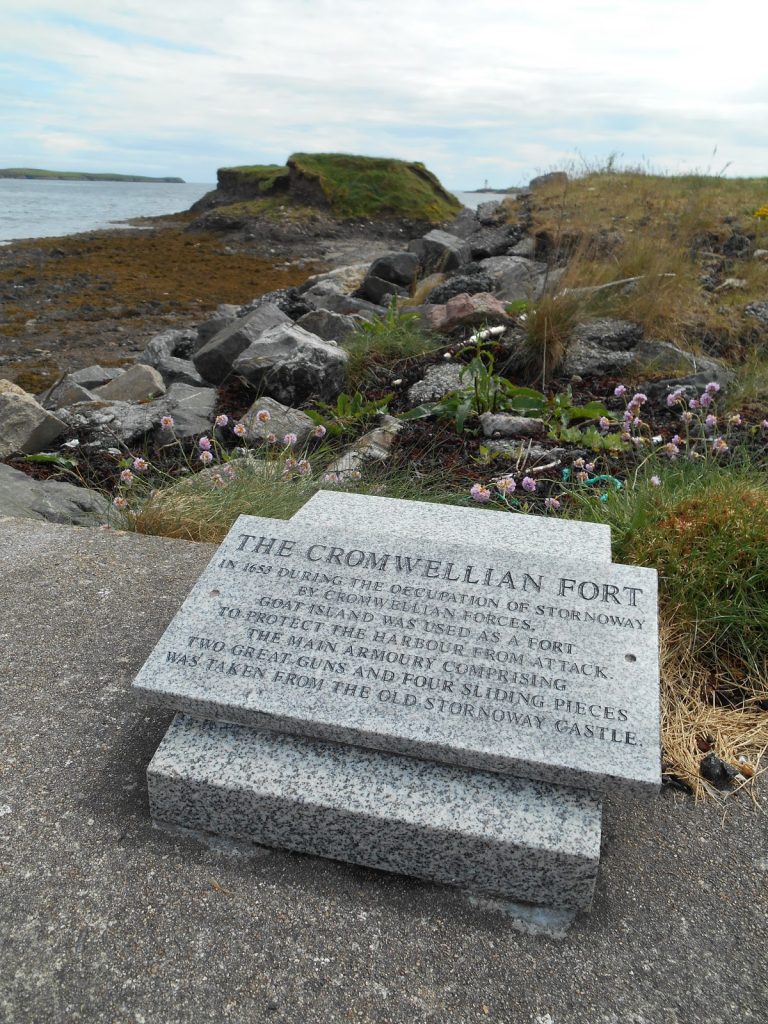
Steòrnabhagh (Stornoway) is another area in which the post-medieval period has been reasonably well-researched, largely as an outcome of development control measures across the modern town which have brought to light remarkable discoveries for this period, such as the location of the Cromwellian fort at Eilean na Gobhail (Goat Island, AOC 2019). Continuity between post-medieval and contemporary settlements and townships in many areas of the Outer Hebrides, such as Steòrnabhagh (Stornoway), means that developer-funded archaeology, specifically relating to urban infrastructure developments, is likely to continue providing key archaeological evidence for this period. However, further research, interpretation and synthesis is needed to bring this evidence into wider post-medieval narratives.
Across the Outer Hebrides the rural landscapes across the Outer Hebrides are characterised by the emergence of nucleated settlements, which come to define the overall structure of much of the islands from at least the 18th century onwards. The excavation of a 16th through to 17th century settlement at Druim nan Dearcag, North Uist, makes an important contribution to our understanding of post-medieval settlement patterns, suggesting the presence of dispersed farmsteads at this point and supporting the view that nucleated settlements were a relatively late post-medieval development (Armit 1997c). However, there is clearly more to understand about the development and ancestry of the Hebridean baile, nucleated settlements, and the wider structure of the landscape throughout this period.
Dykes, sheilings, enclosures and lazy beds represent more than half of the known site data for the post-medieval period. Together, these archaeological features have the potential to contribute substantially to our understanding of changing land management and ownership, agricultural, pastoral and transhumance practices, and impacts of forced eviction, elective emigration and relocation on the rural landscape. Surveys undertaken by community groups have vastly expanded and enhanced this dataset in many areas. What is still lacking, however, is reliable dating, a sense of overall chronology, synthesis, critical analysis and interpretation of this existing dataset and its incorporation into meaningful narratives. How post-medieval settlements articulate with earlier and later settlements and landscape structures also requires further consideration.
Alongside distinct settlement patterns and land management practices, the post-medieval period is also defined by episodes of settlement clearance, directly and in-directly forced emigration and population flux caused in part by a series of economic boom and bust industries. Thus, alongside continuity with modern towns and townships, the post-medieval dataset is also characterised by abandoned settlements, clearance villages and the remains of temporary structures and early industrial infrastructure. The excavation of the temporary dwellings at Rubha Ardvule, for example, highlighted the impoverished living conditions of kelp workers living in South Uist during the early 20th Century (Parker Pearson et al 2004, Grant 2019).
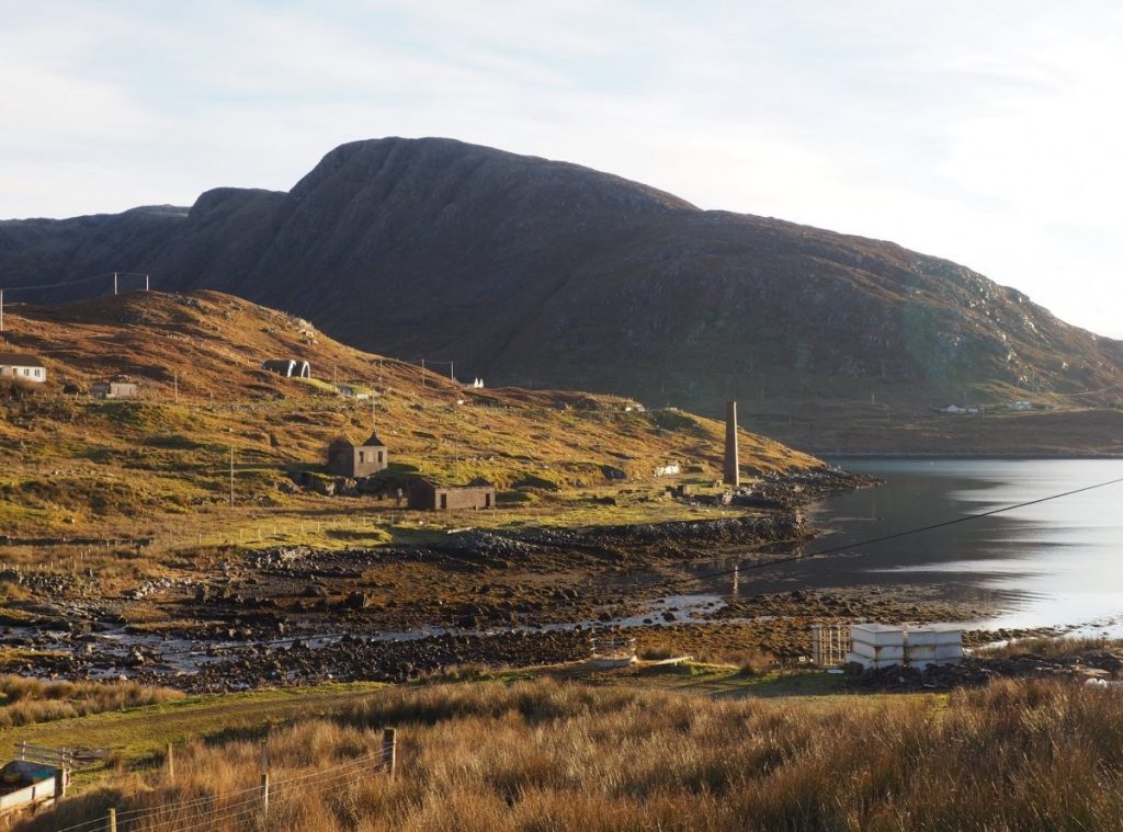
Other post-medieval and 20th century industries represented by archaeological remains include mills and kilns of various kinds, fish processing sites and even a whaling station at Bunavoneader in Harris. Archaeological approaches have a lot to contribute to our understanding of the industrialisation of the islands from the post-medieval into the early modern period. Archaeological material also has the potential to provide alternative perspectives on the lives of working and disenfranchised communities that are often missing from historical sources.
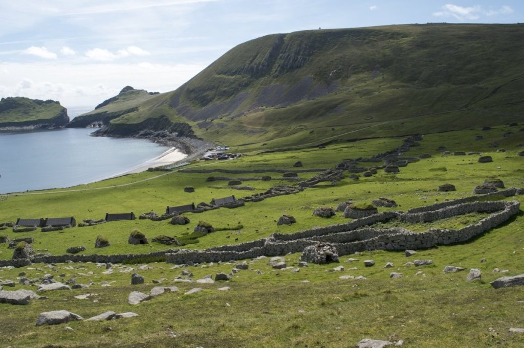
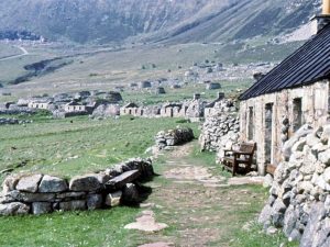
The evacuation of the remaining residents of St Kilda in the early 20th century is perhaps the most-well known example of Scottish island emigration, even though in many ways the narrative here was atypical for the islands as a whole. The enduring allure of the St Kilda story, as well the unique preservation conditions post-evacuation, has meant that the post medieval and early 20th century archaeological remains across St Kilda have been unusually well-researched in comparison with other parts of the Outer Hebrides (SIRFA Case Study: St Kilda). The challenge for archaeologists is not only to better integrate St Kilda’s archaeological material into broader Hebridean narratives, but also to use this existing research as an inspiration for wider Hebridean studies of a similar nature. There have been several archaeological research projects across the Highland region in recent years that focus specifically on using archaeological methods for understanding the impacts of The Clearances at a site specific and wider landscape level, including excavations and surveys of Clearance settlements. Since the completion of the SEARCH project, however, no comparable research has been attempted across the Outer Hebrides. There is clearly immense potential for this type of research to provide alternative perspectives and essential detail, texture and balance for this important period of the islands’ past.
Similar to the medieval period, key opportunities for archaeological research relate to the everyday domestic lives of Hebridean communities, with little significant work addressing this broad topic since the late 1990s (Branigan 1990, Smith 1996, Armit and Campbell 1998, Symonds, 1999, 2000, 2011). From at least the mid-19th century, the local housing vernacular across the Outer Hebrides is defined by thick-walled, drystone-built thatched structures, albeit with regional variations, associated with the term ‘blackhouse’. For some island communities this term is regarded as a pejorative, with Taigh Tughaidh (‘Thatched house’) suggested as more accurate and appropriate terminology. Although a number of these types of building have been investigated archaeologically they remain poorly understood (Branigan and Merrony 2000, Raven and Reynolds 2004, Parker Pearson 2010, Nesbitt et al 2013). Under explored topics include the dating and overall chronology of post-medieval and early modern domestic architecture, the origins of distinctive Hebridean domestic vernaculars and their development over time. Just over 250 ‘blackhouses’ are recorded in the local and national HER, which is certainly a very small fraction of the true number of surviving 20th and 21th century traditional thatched houses across the islands. Thatched buildings of this type are known to have been inhabited into the 1970s. What is less clear is when this distinct vernacular first appeared, how it developed, and what these buildings tell us about the lives of island communities, about domestic dwellings and the use of space, and how domestic life changed throughout this period (Walker and MacGregor 1996, Branigan and Merrony 2000).
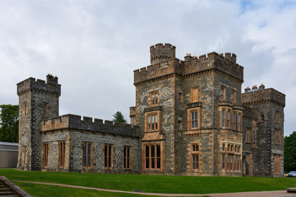
The Outer Hebrides were important to wider political events throughout 17th and 18th centuries that resulted in shifting national identities and allegiances across Scotland. There is still scope, however, for improving our archaeological understanding of the effects of these wider events on island communities and the impact on people’s everyday lives across the archipelago. Changing economic markets and international trade at a national and international level also had important impacts regionally and archaeology has the potential to contribute substantially to these discussions. For example, our understanding of the range and extent of trade links across the region has been enhanced by developer funded survey at Caisteal Leòdhais (Lews Castle) in Steòrnabhagh (Stornoway), which identified the reuse of imported Baltic roof timbers from an earlier building on the site – the late 17th century-built Seaforth Lodge (Addyman Archaeology 2019). The impact of disease epidemics and environmental changes for island communities also require greater attention. The islands’ military history during this period is also well established historically but has similarly received little attention from archaeological researchers. The archaeology of changing religious identity and presence throughout the post-medieval and modern period is another area where the archaeological material has a potential role (Thacker 2013a, Barrowman 2020).
The almost complete lack of 20th and 21th century archaeological research across the Outer Hebrides stands out compared with other areas of Scotland, where contemporary archaeology has grown substantially as a thriving sub-discipline over the last decade. The strategic significance of the Outer Hebrides during World Wars I and II, and more pertinently the Cold War, is ripe for investigation. The restructuring of much of the settled landscapes around Baile a’ Mhanaich (Balivanich) and Steòrnabhagh (Stornoway), for example, during and post-Cold War is crucial for understanding contemporary island communities and how these have developed and changed. There are exciting opportunities for expanding our understanding of the islands’ recent past, and alongside that the complexity of modern island identities, through existing and new archaeological practices.
The Outer Hebrides’ post-medieval and modern periods represent key archaeological research gaps that deserve focused research attention going forward. SIRFA encourages further data collection, collation and analysis relating to all sites and materials of this period. There is a wealth of recorded oral history material for this period, as well as maps, estate records, historical accounts and photographs to complement prospective archaeological research. It is therefore essential that multi-disciplinary approaches, specifically oral histories, ethnographic and historic sources, continue to play a key role in better understanding this period of the Outer Hebrides’ past. There is also scope for more collaborative, international research.
Communities across the Outer Hebrides have a particular interest and connection with the archaeology of the region’s post-medieval period. Community-focused research practices and wider dissemination of results and findings are therefore encouraged. Developer-funded research has a significant role to play in expanding post-medieval datasets and understanding of this period. The research significance and wider value of post-medieval archaeological remains needs to be emphasised. Accurate and thorough recording of post-medieval structures and material culture needs to be prioritised, alongside dating and post-excavation work where appropriate.
You can download the datasheet for more information on the post-medieval sites and c14 dates from the Outer Hebrides.
Outer Hebrides Post-Medieval Research Questions
Historically, the Outer Hebrides have had an oral tradition of localised militias or private armies/navies. Is there any physical evidence to support this?
More information on this question
More information:
The wider Gàidhealtachd have a strong oral tradition of localised militias, led by clan chiefs. Is there any physical evidence of this in the Outer Hebrides, such as at battlefields like Feith na Fala (North Uist)? Should a separation be made between navies and armies in a historical Hebridean context, given their geographical context? It may be possible to address aspects of this question by linking events from historical documents and oral histories with known sites. For example, the attack on the Cromwellian fort in Stornoway can now be linked with the site identified through developer-funded excavation work at Goat Island (AOC 2019).
What is the origin of modern transhumance practices in the Outer Hebrides?
More information on this question
More information:
The movement of livestock between different parts of the landscape for pasture is an established part of the annual cycle of crofting practices in the Outer Hebrides. But when did these transhumance practices start in the Hebrides? Do these crofting practices have their roots in prehistory, or is it a Medieval or post-medieval creation? How deeply has this practice impacted the Hebridean landscape and traditional landscape use?
What impact did disease epidemics during the post-medieval period have on the Outer Hebrides?
More information on this question
More information:
Instances of plague were present in Scotland up to the 17th century but seem to have be relatively contained episodes. What was the impact across the Outer Hebrides? What archaeological evidence, if any, is therefore control measures put in place by authorities such as maritime quarantine or settlement abandonment etc. What archaeological evidence is there for episodes of death and disease in the Hebrides during the post-medieval period?
What do variations in blackhouse architecture tell us about Hebridean society?
More information on this question
More information:
Do variations in traditional, domestic buildings across the Hebrides correlate to chronological evolutions of style, to inter-island differences, or to more complex societal structures? How do turf houses, the addition of chimneys, and appearance of the Whitehouse play into this? Indeed, should we still use the terms blackhouse and whitehouse? In Uist, the term blackhouse is seldom used. Instead, the term ‘taighean tughaidh’ (thatched house) is used to describe domestic dwellings maintained and lived-in throughout Uist by Gaelic communities from the mid-18th until the late 20th century.
What physical evidence is there for the presence of the British army in the Outer Hebrides following the 1745 rebellion?
More information on this question
More information:
The aftermath of the 1745 uprising involved a major military occupation across the Highlands, evidenced by the development of Fort William, Fort Augustus, and Fort George. The extent of the British military presence in the Hebrides has yet to be explored – indeed, it is not known whether there is any physical evidence outwith Stornoway. Does it exist? Is it found across the Hebrides, or are there concentrations in particular areas, such as Stornoway?
How extensive is the archaeological evidence for a 20th century military presence amongst the Outer Hebrides?
More information on this question
More information:
20th century conflicts have had a direct impact on Hebridean life. This is well documented amongst oral histories, in events such as the Iolaire tragedy, and the MoD presence across Benbecula and parts of South and North Uist. To date, this period of the islands’ past has received very little attention from archaeologists. The extent of the physical remains, and their research potential remains unknown. Archaeological survey alongside analysis of interdisciplinary sources is required to begin answering this question. It is hoped that future research questions will come to light through these initial steps. Developer funded archaeological work is already generating data here. Archaeological survey, both commercial and research driven, alongside analysis of interdisciplinary sources is required to further develop these questions. It is hoped that future research questions will come to light through these initial steps.
How did 20th century MoD developments transform Uist’s landscape?
More information on this question
More information:
During the 1950s Uist was chosen as a location for substantial military development. The MoD development brought new jobs and new people to the Hebrides. The developments are also responsible for much of the modern road and public services infrastructure in Uist. What was the impact on land use and the way in which townships were structured and used? Further, what were the wider impacts for the Hebrides and Hebridean communities?
What was the development trajectory of the blackhouse?
More information on this question
More information:
The blackhouse was an integral part of early modern life, however, there is relatively little discussion about the origins of this architectural style and its development. Was this a direct descendent of the Viking longhouse, in the same way the Birlinn was a descendent of the Viking longboat? Additionally, is there a notable difference in built and style between Outer Hebridean blackhouses and blackhouses found in the Inner Hebrides or mainland?
How did relationships between the Outer Hebrides and Ireland change throughout the post-medieval period and into the modern period?
More information on this question
More information:
West coast Scotland and Gaelic culture has close ties to Ireland and Irish culture. This can be seen in clan political machinations involving Irish families as well as the rise of the Redshanks. This relationship likely experienced considerable fluctuations. How did it fluctuate through time? What specifically caused these fluctuations, and what were the impacts? What archaeological evidence is there for contact and cultural relationships over this period? Similarity can archaeological evidence help us understand fluctuations and change in these dynamics?
What was the social impact of military development during the World Wars, and later the Cold War?
More information on this question
More information:
During conflicts throughout the 20th century, the military developed various parts of the Outer Hebrides and constructed some major infrastructure. The most obvious examples of these are Benbecula and Stornoway airport, as well as the later MoD Hebrides. The construction and utilisation of these military installations also required the construction of (temporary) military accommodation. What was the social impact of the arrival of these personnel & the related developments? Did the personnel integrate with the local communities? Archaeological survey and oral history recording projects will be important here.
How did economic connections outwith the Hebrides fluctuate throughout the modern era?
More information on this question
More information:
The idea that Hebridean communities relied largely on unchanging, insular subsistence lifestyles for much for the modern period still persists. What evidence is there for external connections, commerce and trade throughout this period? Howe extensive were external trade networks and what resources were being traded? Moreover, how and why did these connections change over time? During industrial and economic collapse did people return to earlier subsistence practices or were new approaches found? Our understanding of potential booms and busts of the Hebridean economy is currently limited, along with our knowledge of the resources and extent of any international connections. Furthermore, what was the impact on local communities and landowners? This is a huge topic, currently under explored from an archaeological context. It includes, but is not limited to topics on the Clearances. Other impacts that require attention include the seaweed industry, Leverhulme and fisheries.
How were the uplands used during the post-medieval period?
More information on this question
More information:
The Hebridean uplands are typically associated with the use of shielings and seasonal grazing. Whilst many sheiling sites have been recorded across the Outer Hebrides, we still lack a coherent picture of how these transhumance landscapes were structured and how this changed over time. Furthermore, it is not known whether sheilings and seasonable grazing represent the full extent of upland usage during these periods. Are shielings the only building structure present in the uplands? Are there other non-shieling sites that can tell other stories of upland usage? Given the scope of the question and the geographical area of the uplands, this is likely a long-term research area with an initial focus on systematic land surveying. Given the scope of the question and the geographical area of the uplands, this is likely a long-term research area with an initial focus on systematic land surveying. Importance of developer led work here too, for example large scale walkover surveys.
Where are the locations of the unknown individuals washed ashore during the World Wars?
More information on this question
More information:
Until recently it was customary amongst the islands to bury the unknown bodies of those washed ashore nearby where they were found. This includes those washed ashore during the World Wars. Are the locations of all of these burials known or recorded? Can the tides and currents be used to predict the location of those not recorded? Is it possible to now identify these individuals? Due to their proximity to the shoreline, many are now at risk of being lost to erosion. What is the ethical response to this?
If you have answered a research question, or have an update to add about a specific site or period, you can use our inline comments to flag the change and keep the frameworks up to date.
Register for an account, or login now to add updates and comments to our existing frameworks.