2000s to present
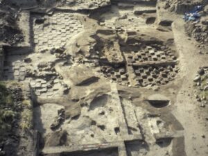
Excavation-based, university-led research from the 2000s to the present day have been comparatively small scale compared to those from the two previous decades, although some key projects have been running for multiple years. The work has been characterized by a renewed focus on the problem of coastal erosion and sense of community ownership of heritage and its protection. Key here are the Uist and Benbecula Coastal Zone Assessments Surveys (Johnson et al 2005, Moore and Wilson 2005, Sneddon 2006, Johnson et al 2007, Moore and Wilson 2007) and the coastal survey at Calanais (Hambly 2021) commissioned by the SCAPE Trust and the subsequent community excavations at Baile Sear (Kinnaird et al 2019), Loch Phaibeil (Loch Paible), North Uist, and Lionacleit (Liniclate), Benbecula (SIRFA Case Study: Lionacleit, Hambly and Timpany 2019). The SCAPE Trust commissioned surveys were an extension of an earlier series of coastal surveys commissioned by Historic Scotland across Lewis (Burgess and Church 1997a, 1997b) and Barra (Branigan and Grattan 1998, Branigan 2003) undertaken by the University of Edinburgh and SEARCH project teams respectively.
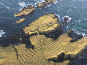
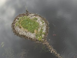
The SCAPE Trust continue to update the coastal survey records via their CoastArch project. Also notable are the evaluations undertaken by Channel 4’s ‘Time Team’ at Allathasdal (Allasdale), in Barra, leading to subsequent excavation of cist graves and stone structures by Wessex Archaeology (unpublished, but see Turnbull 2019). This era has also seen archaeological researchers deliberately pushing their fieldwork beyond the machair to gain a more complete picture of landscape usage in the past. This has required new methods for site prospection and excavation in what are arguably challenging locations. The Severe Terrain Archaeological Campaign (STAC), set out to survey a sample of coastal sea stack sites around the Isle of Lewis and led to the excavation of Dùn Èistean (SIRFA Case Study: Dùn Èistean, McHardy et al 2009, Barrowman 2015a). Also pushing methodological boundaries, the Islands of Stone and Neolithic Stepping Stones projects (SIRFA Case Study: Islands of Stone), led by researchers from Reading and Southampton Universities saw the survey and excavation of islet dwellings across the Outer Hebrides to expand understanding of the nature of Neolithic settlements (Garrow et al 2017a, Garrow and Sturt 2019, Hammann et al 2022, Blankshein et al 2023).
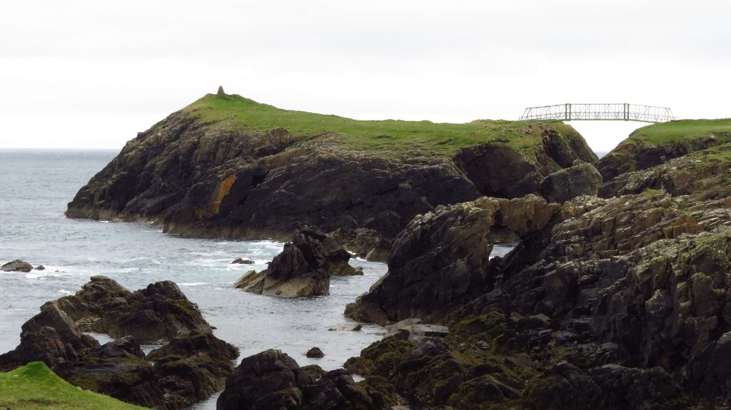
This period has also seen renewed interest in the archaeology across Harris from researchers based primarily at Durham and Birmingham Universities, including retrospective publication of the 1960s excavation at Taobh Tuath (Northton) alongside a new programme of fieldwork and extensive survey here (Simpson et al 2006, Colls and Hunter 2010, 2015). These Harris-based projects have substantially increased knowledge and understanding of what had become a forgotten island within wider archaeological narratives. They also revealed crucial information about the Hebrides’ earliest known communities, their diet and subsistence practices through the application of a range of new scientific techniques (Bishop et al 2021). The last 15 years have also seen the long-awaited publication of key excavations from the SEARCH Project including Bornais (Sharples 2012, 2019, 2021), Cladh Hallan (Parker Pearson et al 2021, Parker Pearson et al forthcoming), Cille Pheadair (Kilpheder) (Parker Pearson et al 2018) and Cill Donnain (Kildonan) (Parker Pearson and Zvelebil 2014), as well as wider survey work and smaller scale excavations undertaken by the project (Parker Pearson 2012). Additionally, this period has seen the posthumous publication of Ian Crawford’s Neolithic site at Coileagan an Udail (Udal) (Ballin Smith 2018).
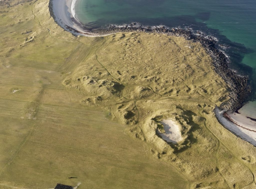
Alongside this, ongoing analysis of faunal material from key South Uist sites, led by Jacqui Mulville at Cardiff University, has combined zooarchaeological analysis with wider scientific analysis including stable isotopes, residue, ancient DNA and biomolecular techniques. The results of this have informed wider debates regarding animal and human interactions, evolution and movements over time (Craig et al 2000, Mulville 2002, Mulville et al 2003, Craig et al 2005, Mulville et al 2005, Mulville and Thomas 2005, Mulville et al 2009, Mulville 2010, Cramp et al 2015, Mulville 2016, Best and Mulville 2014). Importantly, over the last two decades the exceptional preservation of material, sites and landscapes across the Outer Hebrides have shown that these islands continue to play a pioneering role in the development of new, and at times exploratory, archaeological techniques, methods and approaches that have relevance and application beyond the islands themselves.
From the late 1990s onwards, the emergence and growth of developer-funded archaeology has complemented University-led research across the Outer Hebrides. Although there has been comparatively less development across the Outer Hebrides than in mainland or urban areas, mitigation in response to road-widening schemes, causeways, housing plot developments and other infrastructural development has shown the potential for developer-funded work to fill much needed knowledge gaps. For example, archaeological investigations associated with the Berneray causeway and road widening at Langais (Langass), North Uist revealed crucial new evidence for Neolithic settlement activity (Downes and Badcock 1998, Holderness 2007) at a time when very few sites of this period had been identified. Similarly, our understanding of formal Iron Age burials has only come to light through developer-led evaluation work (Cook 2018). The development of the renewables industry, specifically windfarm developments, brings with it new and growing opportunities for archaeological investigations in previously under explored parts the Outer Hebridean landscape.
| Project title | Research dates | Island | Project description | Institution | Funders/partners | Key publications |
| Outer Hebrides Coastal Community Marine Archaeology Pilot Project (OHCCMAPP) | Completed 2013 | Various | Enhancing the archaeological records of the intertidal and marine zones in the Outer Hebrides with a strong focus on community engagement | Wessex Archaeology Coastal and Marine | Wessex Archaeology Coastal and Marine, Historic Environment Scotland, and communities of the Outer Hebrides. | Bicket et al 2014 Outer Hebrides Coastal Community Marine Archaeology Pilot Project (OHCCMAPP) | Our Work | Wessex Archaeology |
| Scottish Atlantic Maritime Past: Heritage, Investigation, Research, and Education (SAMPHIRE) | 2013-2015 | Various | Enhancing the archaeological records of the intertidal and marine zones in Western Scotland with a strong focus on community engagement, informed by the previous OHCCMAPP | Wessex Archaeology Coastal and Marine | The Crown Estate, Wessex Archaeology Coastal and Marine | McCarthy and Benjamin 2017 Project SAMPHIRE | Our Work | Wessex Archaeology |
| The Papar Project | 2008 | Various | Historical and archaeological survey of named places relating to the ‘Papar’ (priests or monks) in the Northern Isles, Hebrides, and north Mainland Scotland. | University of St Andrews | Carnegie Trust | The Papar Project Clancy 2023 |
| Archaeological signatures of landscape and settlement change on the Isle of Harris | 2004-2011 | Harris | Archaeological survey and excavation in Harris including work at Niseabost and Borgh (Borve) (South Harris), an archaeology of fishing project at Scalpay and Meavag | University of Birmingham and Durham University | Colls and Hunter 2010; Colls and Hunter 2015 | |
| Submerged Neolithic of the Western Isles | 2016-2018 | Lewis | Investigation of artificial and modified islet sites in Lewis using topographic and bathymetric survey, photogrammetry, and terrestrial excavation | University of Southampton; University of Reading | British Academy, Leverhulme Trust, Honor Frost Foundation | Garrow and Sturt 2017 |
| Palaeolandscape reconstruction in the Calanais environs (NB get actual title from CRB) | Lewis | Reconstructing the palaeolandscape of the Calanais landscape using terrestrial coring/geophysics and coring and geophysics at Loch Ròg (Loch Roag) | University of St Andrews Richard Bates, Tim Raub (University of St Andrews | Geophysical Investigation of the Neolithic Calanais Landscape | Bates et al 2019 | |
| Building the Great Stone Circles of the North | 2002- 2003 | Lewis | Research project concerning the stone circles at the Calanais complex and Druim Nan Eum (Na Drommanan,Calanais XI), including excavation at Calanais in 2002, Druim Nan Eum in 2003, and surveys of possible quarry sites | University of Manchester | Richards 2013 | |
| Investigating astronomical alignments at Calanais | Completed 2014 | Lewis | Fieldwork (non invasive) at the Calanais complex | M. R. Curtis, G. R. Curtis | ||
| Ness Archaeological Landscape Survey (NALS) (undertaken as part of DEAP, above) | 2006-2007 | Lewis | Undertaken as part of the DEAP, the survey recorded over 1500 sites from the early Neolithic to post-WW2, at Ness, Lewis | Ness Archaeological Landscape Survey – Outreach in Scottish Archaeology | OSCA Barrowman 2015b | ||
| Carnan a Ghrodhair, Habost, Excavation and survey | 2017 | Lewis | Excavation and survey at the Souterrain at Carnan A’ Ghrodhair, Lewis to facilitate/improve the conservation of the site. | Historic Environment Scotland | Comunn Eachdraidh Nis (Ness Historical Society) | |
| STAC: The Severe Terrain Archaeological Campaign | 2003-2005 | Lewis | Survey of archaeological sites in the coastal zone and assessment of risk and vulnerability to coastal change | Macleod, et al 2009 | ||
| Excavations at Orosay | 2018 | South uist | Excavation of Iron Age mound at Orasaigh (Orosay), South Uist | Cardiff University | Sealladh na Beinne Mòire and Community fund, Cardiff University | |
| Sgeir nam Portan | 2022 – ongoing | South Uist | Excavation of an eroding, late Neolithic site | UHI NWH | Sealladh na Beinne Mòire and Community fund | |
| Sloch Sabhaidh community excavations, Baile Sear | 2006-2010 | Baile Sear | Excavation of an eroding Iron Age wheelhouse settlement | SCAPE | Baile Sear, North Uist – The SCAPE Trust | |
| Loch Paible, community excavations | 2013 | North Uist | Evaluation of eroding features at Loch Phaibeil (Loch Paible) | SCAPE | Loch Paible, North Uist – The SCAPE Trust | |
| Guerilla archaeology – Craftwork Project | 2022 | Various | Using archaeological artefacts from the Outer Hebrides to enhance community development, and support sustainable educational, economic, heritage, environmental and tourism impacts. | Cardiff University | Guerilla Archaeology | Creative engagement with changing times | |
| Wild Things – Developing sustainable food systems in prehistory. | 2022-Ongoing | Various | Through a close examination of the introduction, management, adaptations and, for some islands, the eventual extinction of deer, this project explores these distinctive and sustainable ways of living with wild animals across Scotland’s outer islands. | Cardiff University | British Academy | Wild Things? Developing sustainable food systems in prehistory. | Guerilla Archaeology Stanton et al 2016 |
| Dùn Mhùlan | 2018 | South Uist | Archaeological investigations in advance of reinforcement of the concrete apron coastal defence | AOC | Historic Environment Scotland | |
| South Uist Archaeological Survey | 2023-2024 | South Uist, Benbecula, North Uist | The primary aim of the project is to enhance the National Record of the Historic Environment (NRHE) through a combination of survey techniques | Historic Environment Scotland | Historic Environment Scotland | |
| Sober Island Community Engagement Excavations 2022 | 2022-ongoing | Lewis | Community evaluation at Aird A Chleirich (Sober Island), a small promontory at the entrance to Steòrnabhagh (Stornoway) inner harbour. | Stornoway Trust | National Lottery Heritage Fund and Stornoway Trust | |
| Islands of Stone – exploring artificials islets in the Western Isles | 2021-2023 | Various | Further investigate artificial islets (often known as crannogs) across the Outer Hebrides. | University of Southampton; University of Reading, Historic Environment Scotland | Arts Humanities Research Council | (Blankshein et al 2023) |
Continue reading: Rannsachadh PhD o chionn ghoirid (Recent PhD research)