SWSARF Key Knowledge Sites

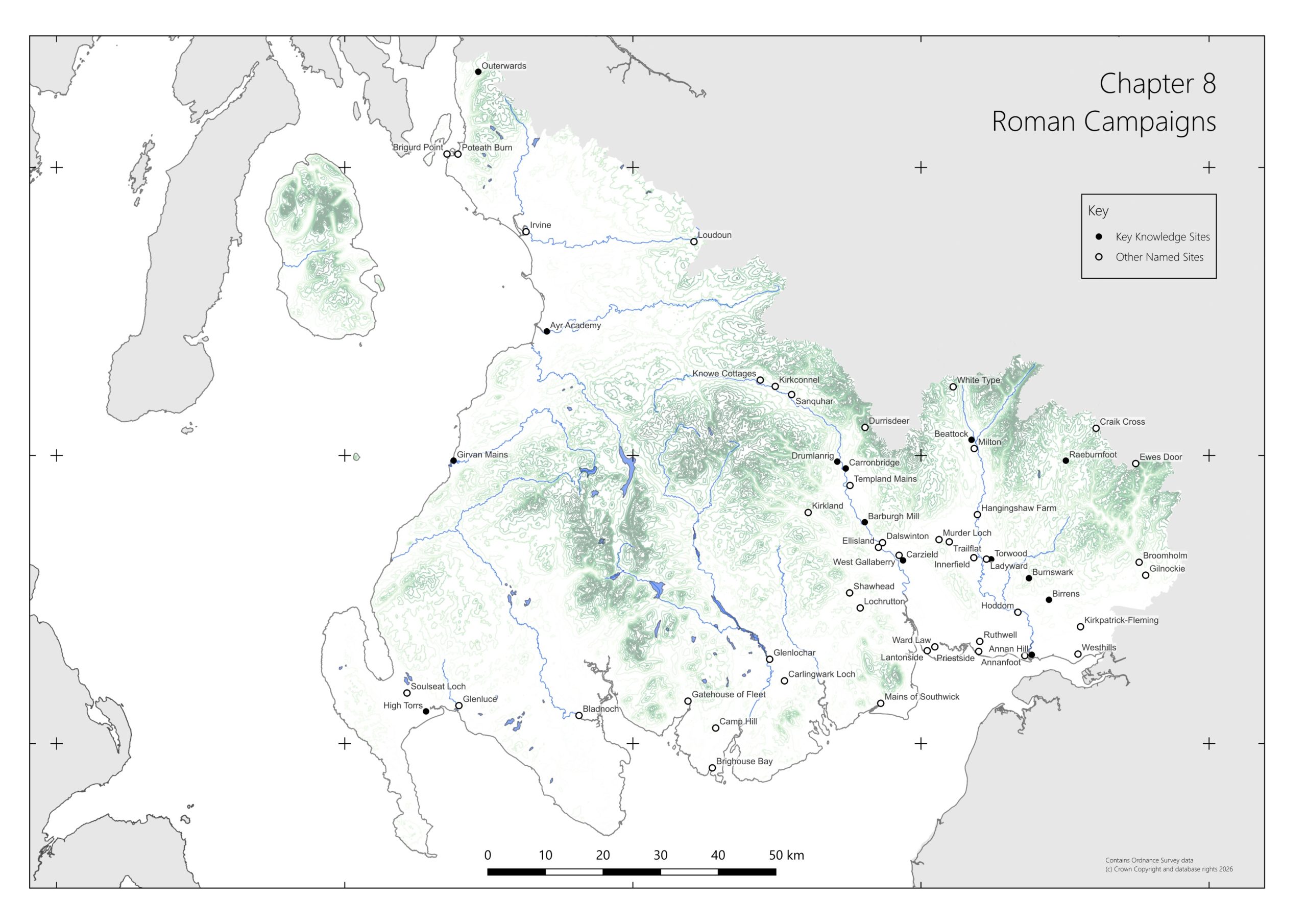
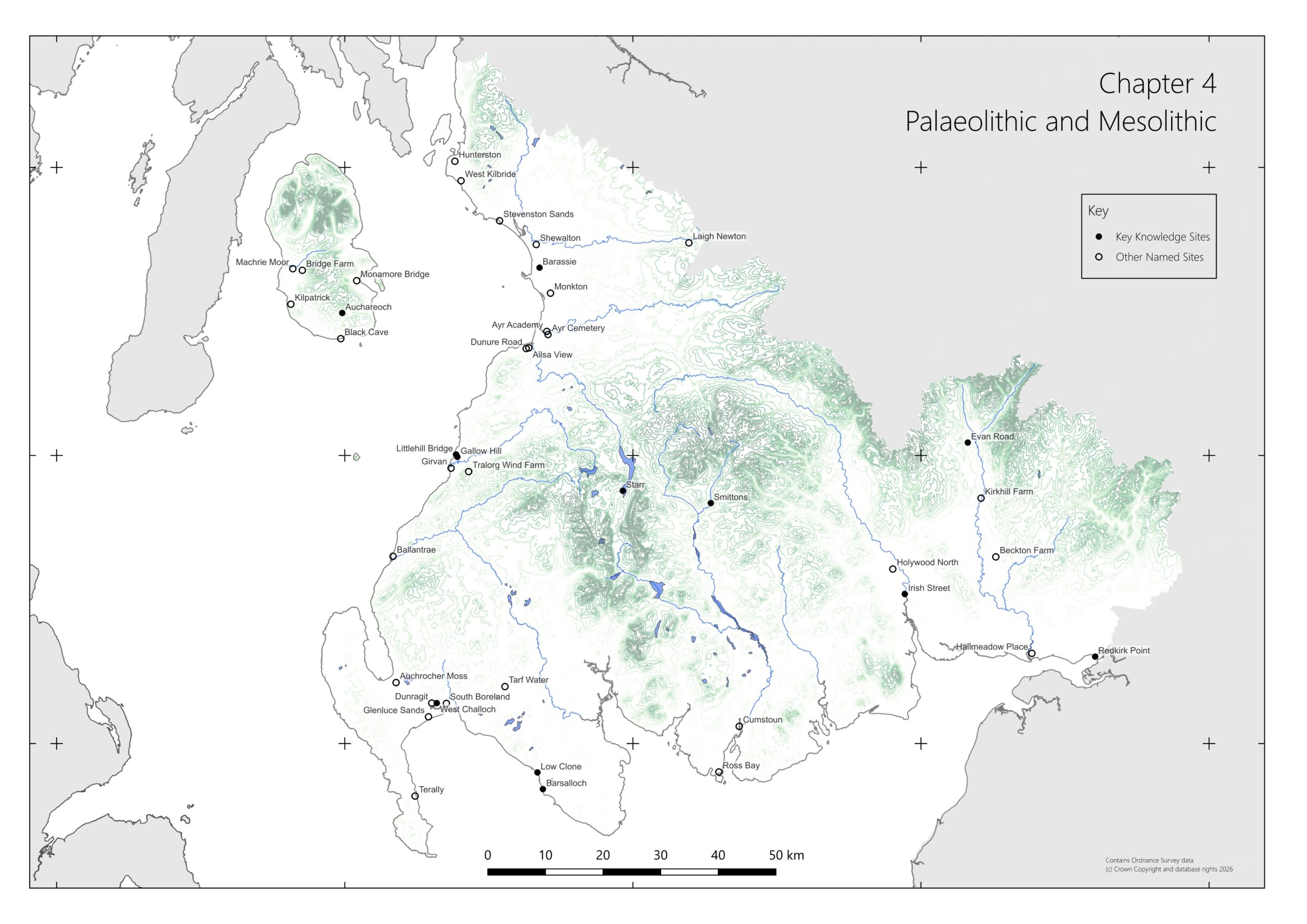
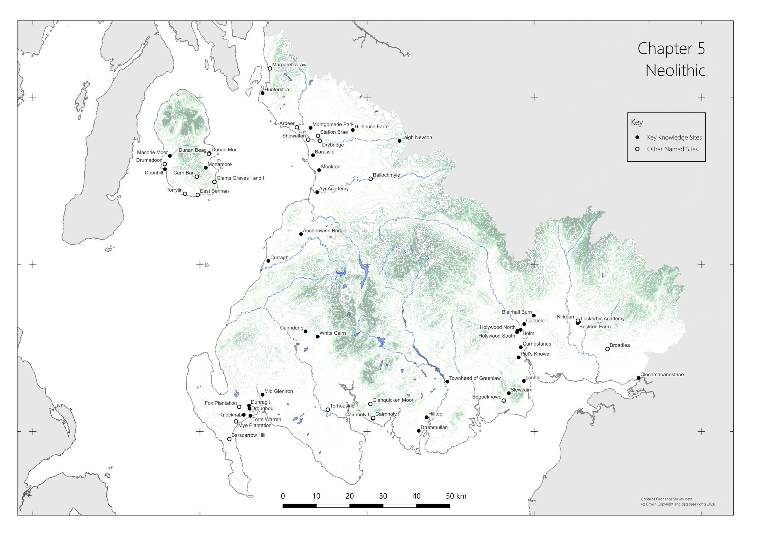
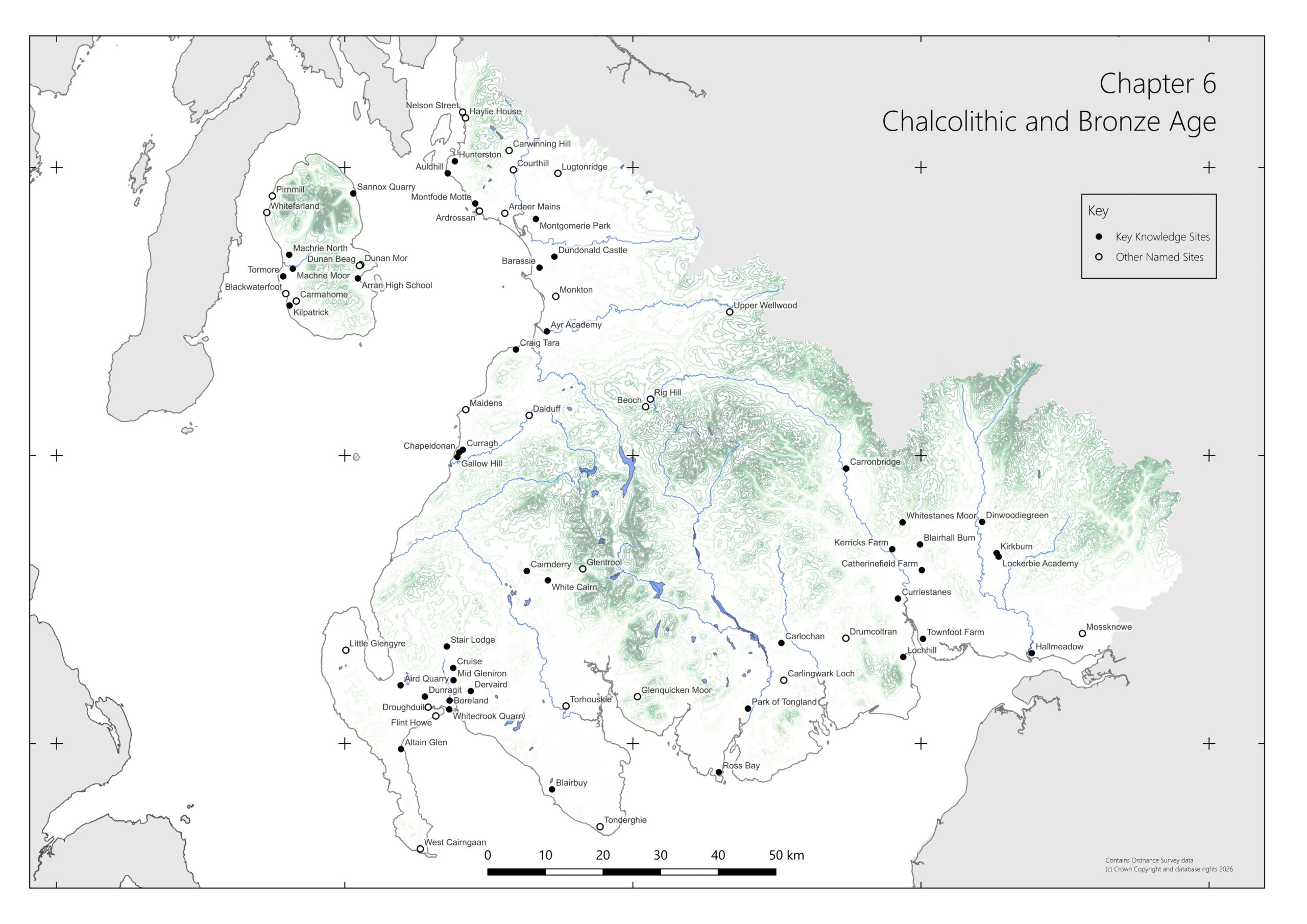
Below are distribution maps showing sites mentioned in the SWSARF chapter drafts. You can also download a summary of the SWSARF Key Knowledge Sites and the SWSARF Bibliography as Word documents. These are both emerging documents that will be added to as the research framework is developed.

Click on the individual maps to enlarge the image on a new tab.

Palaeolithic & Mesolithic

Landscape plan of South West Scotland showing topography, rivers and coastline. The plan is overmarked with the location of Key Knowledge Sites and Other Named Sites for Chapter 4 Palaeolithic and Mesolithic
Chapter 4 Key Knowledge Sites and Other Named Sites © Rathmell Archaeology Ltd

Neolithic

Landscape plan of South West Scotland showing topography, rivers and coastline. The plan is overmarked with the location of Key Knowledge Sites and Other Named Sites for Chapter 5 Neolithic
Chapter 5 Key Knowledge Sites and Other Named Sites © Rathmell Archaeology Ltd

Chalcolithic & Bronze Age
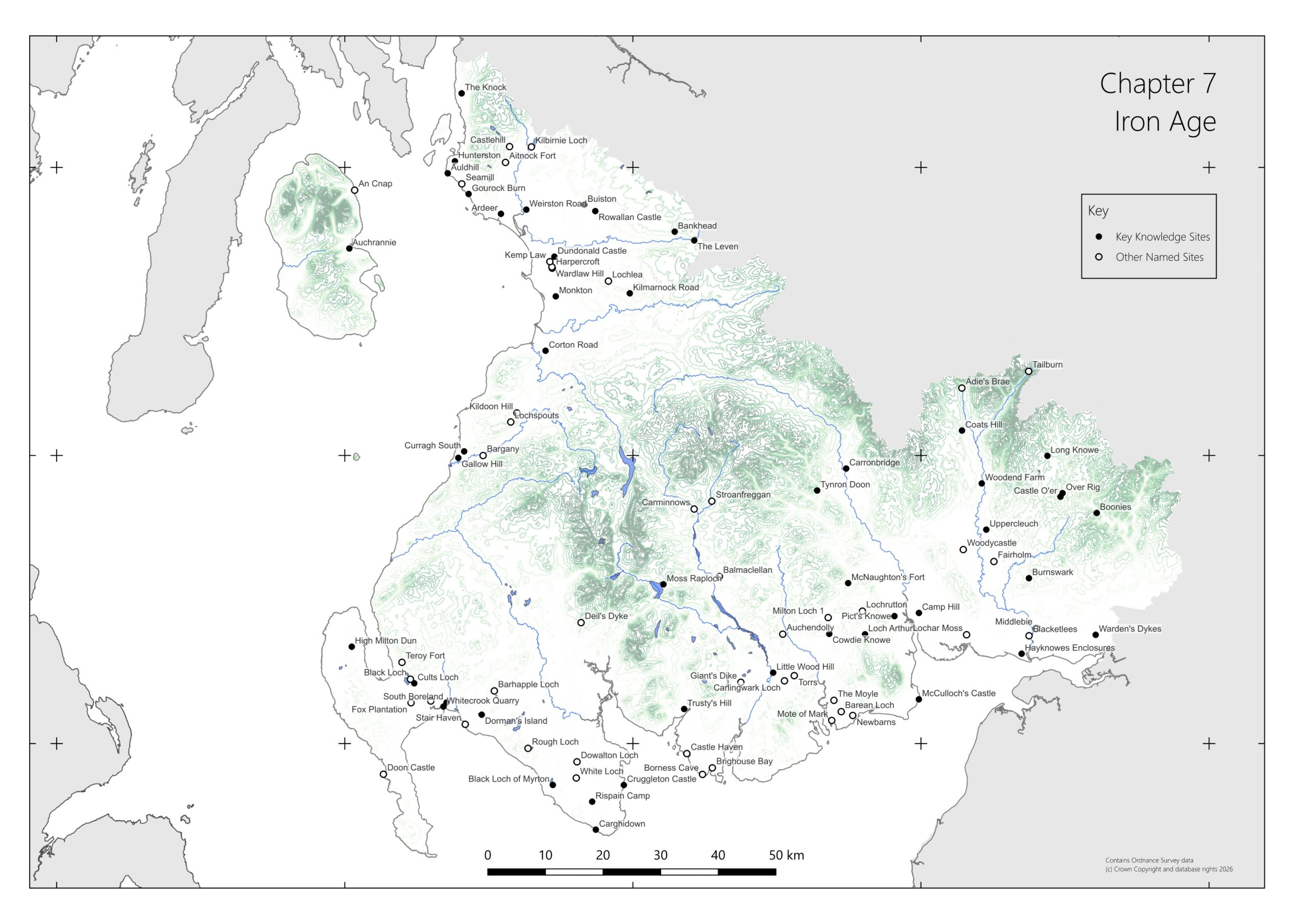
Landscape plan of South West Scotland showing topography, rivers and coastline. The plan is overmarked with the location of Key Knowledge Sites and Other Named Sites for Chapter 6 Chalcolithic and Bronze Age
Chapter 6 Key Knowledge Sites and Other Named Sites © Rathmell Archaeology Ltd

Iron Age

Landscape plan of South West Scotland showing topography, rivers and coastline. The plan is overmarked with the location of Key Knowledge Sites and Other Named Sites for Chapter 7 Iron Age Age
Chapter 7 Key Knowledge Sites and Other Named Sites © Rathmell Archaeology Ltd

Roman Campaigns

Landscape plan of South West Scotland showing topography, rivers and coastline. The plan is overmarked with the location of Key Knowledge Sites and Other Named Sites for Chapter 8 Roman Campaigns
Chapter 8 Key Knowledge Sites and Other Named Sites © Rathmell Archaeology Ltd