One of the Outer Hebrides’ most exceptional qualities is the high level of preservation; not only of materials, structures and sites but, in many places, of entire archaeological landscapes. This circumstance is, in part, a factor of the prevalence and persistence of small-scale subsistence farming into the present day, minimal modern industrial activity and development and, by modern standards, small resident populations. The outcome is that this region is extremely well suited to studies that extend beyond the isolated site to consider broader, landscape-scaled questions and approaches. Landscape approaches are especially valuable to archaeological research across the Outer Hebrides because the environment is so tightly interwoven with the islands’ human history and prehistory.
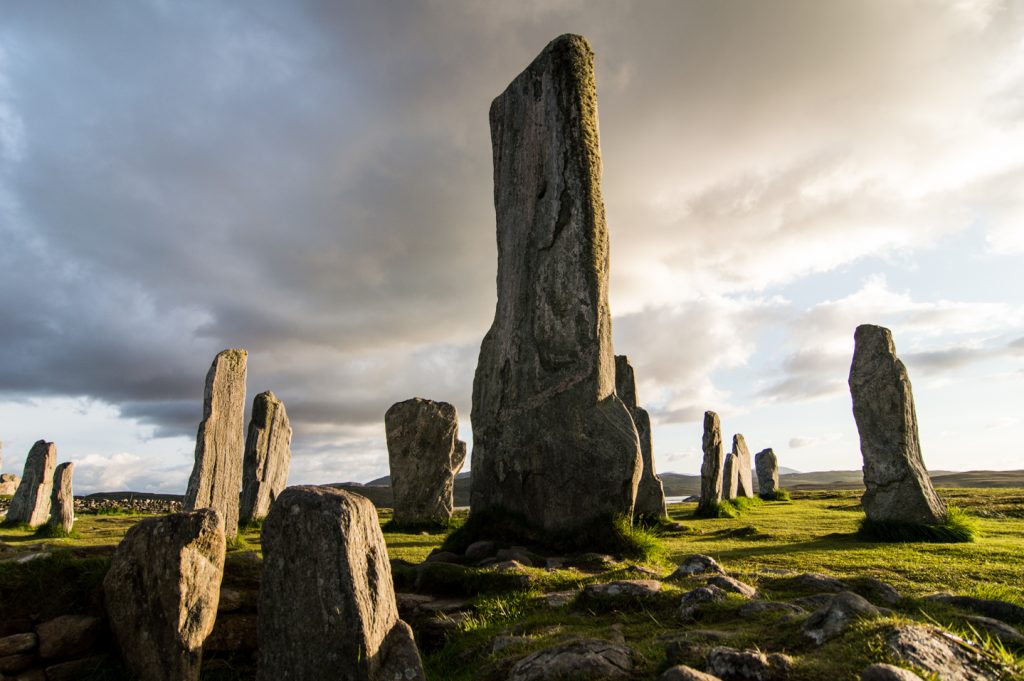
The SEARCH project (Sheffield Environmental and Archaeological Research Campaign in the Hebrides) is a prime example of archaeological research that successfully extended beyond the site boundary to consider the connections across and between places and landscapes over time, informed and contextualised by detailed palaeoenvironmental studies (Sharples et al 2004, Parker Pearson 2012). Other research programmes and projects of note include the University of Edinburgh’s extensive work across the Bhaltos Peninsula, Lewis (Armit 1988, 1997b), survey work across Harris led by researchers from Birmingham and Durham Universities (Colls and Hunter 2010; 2015), the Ness Archaeological Landscape Survey led by Guard Archaeology (Barrowman 2015b) and The Severe Terrain Archaeological Campaign (STAC, McHardy et al 2009). Unsurprisingly, the Calanais complex has also attracted numerous researchers keen to understand these monuments within their wider landscape context and from the perspective of lived experiences (Curtis 1979, Ponting and Ponting 1981, Richards 2013, Bates et al 2019).
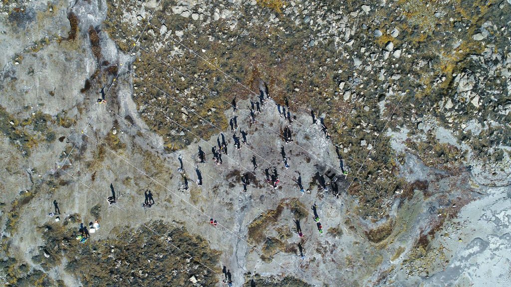
More recently, researchers from Reading and Southampton Universities brought together a range of techniques for exploring the structure and character of the islands’ Neolithic landscapes, combining walk-over, underwater and drone surveys, water-penetrating radar and AI analysis of aerial and satellite imagery (Dixon and Topping 1986). Researchers from Historic Environment Scotland have similarly used a combination of desk and field-based survey techniques to enhance the National Record of the Historic Environment for South Uist (Geddes forthcoming). There are also a number of thriving community organisations across the Outer Hebrides who engage in landscape survey work and are similarly expanding the number of known archaeological sites and features across the region. Walk-over surveys and desk-based assessment work as part of planning consent conditions bring forth similar data. What is required, however, is more synthesis, critical analysis and contextualisation of this growing dataset, as well as a need for chronological refinement and interpretation. This is notably the case for the post-medieval period, for which we have a dataset three times larger than all prehistoric periods combined.
Yet, our understanding of the structure, use and character of post-medieval landscapes remains comparatively poor. Innovations in technology and approach, especially with regard to remote sensing, the use of geographic information systems and machine learning, are all likely to play an increasingly important role in university, community and commercially led research. Moreover, given the exceptional preservation of archaeological landscapes across the Outer Hebrides, there is the potential here to further drive the development of innovative and multi-disciplinary approaches to landscape studies.
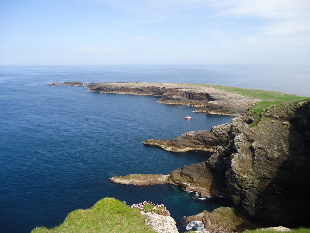
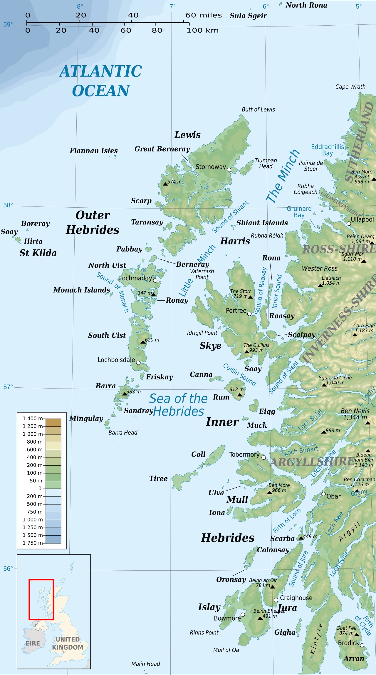
There are also geographic gaps around some of the Hebrides’ smaller, uninhabited islands. There are approximately 50 individual islands within the archipelago where archaeological remains have been recorded and many more where there have been minimal or no archaeological investigations at all. Of special mention, however, are the islands of St Kilda and North Rona. St Kilda is located approximately 64 km west of the Outer Hebrides at its shortest crossing. These islands are well-known as the only World Heritage Site in the UK designated for both cultural and natural values. The archaeological remains across St Kilda has been relatively well researched (Harman 2008, Gannon and Geddes 2016). However, archaeological narratives for St Kilda tend to view these islands in isolation, separated from the wider Hebridean archipelago. By comparison, North Rona, arguably even more ‘remote’ than St Kilda at 72 km north-north-east of the Butt of Lewis, has received little research attention since the RCAHMS surveys in the 2010s and Jill Harden’s 2013 work, despite demonstrable research potential (see also Nisbet and Gailey 1960).
Geographic gaps relate not only to specific islands, but also to wider landscapes. There are parts of the Outer Hebrides that represent some of the most comprehensively investigated and understood archaeological landscapes across Scotland. However, beyond these discrete pockets of very detailed archaeological information there are large geographic gaps. Beyond Bhaltos, Ness, and Calanais, large parts of the archaeological landscape across the Isle of Lewis remain poorly understood. Similar arguments can be made for most of Harris, large parts of Barra, and most of Benbecula. Across the archipelago as a whole, east-coast prehistoric settlements remain poorly understood in comparison to those on the west coast. The majority of archaeological survey and almost all excavation over the last four decades has focused on the west coast. Where research has considered the island interior this has focused largely on islet settlements with the moorland loch-systems (although see relevant chapters in Parker Pearson 2012). The apparent west-coast dominance within university-led archaeological research is compounded by the fact that other key routes to archaeological knowledge (developer-led and rescue excavation) also frequently lead to investigation of these same landscapes. Consequently, dominant narratives and supporting archaeological data have a tendency towards west-coast bias.
Access and resourcing are key research challenges. Nevertheless, understanding of settlement and land use across the wider island landscapes of the Outer Hebrides will retain geographic gaps until researchers find ways to address these challenges. The SIRFA resource and research assessment specifically highlights the need for better geographic distribution and integration of archaeological research across the full suite of island landscapes.
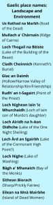
Language remains an underutilised tool in archaeological landscape studies; naming and articulating the physical world is fundamental to the process of landscape and place making and Gaelic place names, oral histories, and historical records provide a rich resource embedded with information about how people have used, moved, experienced and perceived these places. The relevance of Gaelic to our understanding and interpretation of medieval and post-medieval landscapes is well established (Cheape 1999, 2014, 2017, 2021, Grant 2013, 2016). However, the value of Gaelic as a resource tool for landscape studies extends back into prehistory. In these contexts, Gaelic resources provide tools for identifying previously unknown sites as well as offering an alternative perspective on dwelling in island landscapes which can prompt new ways of thinking about and understanding the past. For archaeologists seeking a holistic and meaningful understanding of past landscapes, knowledge and understanding of Gaelic language is an essential research tool.
Environmental research is central to understanding the formation of settled landscapes across the Outer Hebrides and there has been a long history of palaeoenvironmental research across the region. Much of this research dates back to the 1980s and 90s. It was at this time that the full significance and potential of Outer Hebridean material for addressing wider questions about human-environment interactions was first fully demonstrated, largely as a result of a series of well-funded university-led research projects. The SEARCH Project, for example, was initially driven by questions around the nature and causes of environmental and ecological changes across the islands, further motivated by the exceptional preservation of environmental data encountered by these pioneering researchers (Gilbertson et al 1996, 1).
Whilst our understanding of past environments has continued to evolve for the Outer Hebrides, the overall picture remains patchy – largely because the key environmental processes at play lack uniformity and have a high degree of local variation. Thus, ongoing environmental research is critical for attaining a more detailed and nuanced understanding of past environments across the Outer Hebrides and an improved understanding of how, when and what instigated environmental changes. Related to these broad research imperatives are questions around how the islands’ prehistoric and historic communities were impacted by and responded to their environments and environmental changes. That said, several important insights have emerged across different periods and themes.
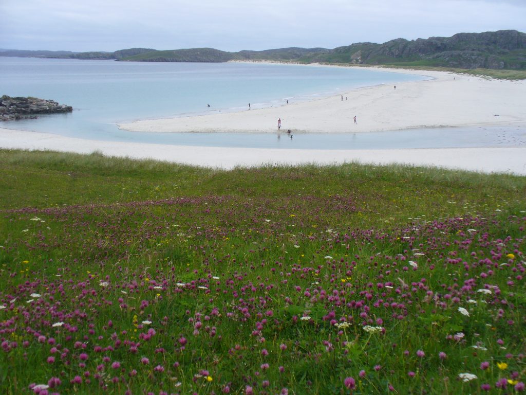
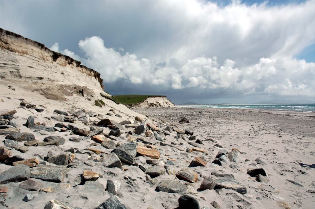
Much of the west coast of the Outer Hebrides is defined by machair: a Gaelic word that refers to a series of low-lying environmental zones formed from windblown, calcareous (marine shell) sand overlain by grassland. Machair is a unique landform found only across the Outer Hebrides and parts of Ireland, shaped over millennia by both natural and cultural processes. Machair soils are highly alkaline, free-draining and the wider machair system characteristically dynamic. Archaeological preservation and visibility on the machair is also notably high (Barber 2011, Parker Pearson et al 2011). Current thinking places machair formation from at least 6,000 BC and a period of stabilisation from the beginning of the Bronze Age (Ritchie 1979, Schwenninger 1996, Gilbertson 1997, Whittington and Edwards 1997, Barber 2000, Edwards et al 2005). However, the processes involved are complex, the chronology highly variable and it remains unclear whether machair stabilisation occurred uniformly across the Outer Hebrides, or even across individual islands (Whittington and Edwards 1997). From the Bronze Age the machair appears to have been a highly attractive landscape for early farmers, however it is still unclear when settlements and exploitation of the machair first began and how strategies for working and manging these highly dynamic environments evolved and changed over time.
Today, the islands of the Outer Hebrides are characterised by an almost complete lack of native arboreal vegetation. Importantly, up until the 1980s, it was widely accepted academically that the Outer Hebridean islands had never supported substantial woodland. This opinion appeared to be confirmed by analysis of one of the earliest pollen core samples taken from Loch Ròg Beag (Little Loch Roag), Lewis in the 1970s, which identified an almost complete absence of arboreal pollen species over all periods (Birks and Marsden 1979). However, this interpretation conflicted with historic accounts of sub-fossilised tree remains not only within inter-tidal zones but also at the base of peat cuttings (see for example Beveridge 1911). An earlier study of molluscs from Taobh Tuath (Northton) also presented data inconsistent with this narrative (Evans 1971). Palaeoenvironmental research carried out during the 1980s and 1990s substantially altered what had been an established view point.
The growing corpus of environmental data since that point suggests that arboreal species began to colonise the Outer Hebrides at the beginning of the Holocene, with initially wooded landscapes gradually replaced by heathland, moorland and blanket peat (Bohncke 1988, Bennet 1990, Edwards et al 1995, Fossit 1996, Edwards and Brayshay 1996, 2000, Brayshay et al 2000, Edwards et al 2000, Mills et al 2004). This shift in interpretation was facilitated by an enhanced environmental dataset and highlights the value of ongoing archaeological research on these topics and the potential for new data to alter and refine established perspectives, and to add texture, nuance and local detail to regional narratives. For example, recent work by the SCAPE Trust, alongside researchers from the University of the Highlands and Islands, focussed on inter-tidal sub-fossil tree remains at Lionacleit (Liniclate) beach in Beinn na Faoghla (Benbecula). This work has painted an evocative picture of an early prehistoric landscape defined by tangled willow, with occasional birch and Scots pine, alongside open, grassy areas and marshland (SIRFA Case Study: Lionacleit, Hambly and Timpany 2019). Most studies suggest that peat cover was expanding across the Outer Hebrides from at least 5,000 years ago with several indicators of deliberate management of these environments from early prehistory (Edwards et al 1995, Piper et al 2018). However, the chronology of blanket peat formation across the region is complex. Like machair development, these processes lack uniformity and display a high degree of local variation, and further research is again required to refine our understanding.
Questions remain about the process and chronology of woodland decline and associated moorland and peat expansion, including a better understanding of how early prehistoric communities impacted these environments through subsistence practices, landscape management and farming strategies. Alongside this, there is an apparent pattern of fluctuating abandonment and reoccupation of the island interior that requires further explanation from an environmental and landscape perspective. Likewise, the motivations and mechanisms for the apparent settlement shift away from the machair during the early medieval period is poorly understood. Historic records highlight periods of environmental change, deteriorating climate and increased instability of machair environments during the early part of the medieval period but there is more to understand, specifically at a local level, with regard to impacts on island communities.
The Outer Hebrides account for approximately one-sixth of Scotland’s total coastline, extending over 3,000 km in length. The coast is undeniably a significant element of the Outer Hebridean environment and landscape, both past and present and understanding how this coast has changed over time remains a crucial area of archaeological research. A’ Mhaoil (the Minch) is a deep-water sea channel which seemingly separated the Outer Hebrides from the Scottish Mainland from long before the Ice Age. However, what are now individual islands across the Outer Hebridean archipelago were, in early prehistory, likely a single landmass. Researchers from the University of Southampton have modelled long-term sea level rise and coastal change across the Outer Hebrides providing a much-needed baseline for understanding the evolving geography of these islands (Blankshein 2021, Jordan 2004). However, there is still much more to understanding here. The islands’ pre-Neolithic coastlines, the effects of isostatic rebound and shifting land-sea boundaries across the earliest prehistoric periods are especially poorly understood and this directly effects our ability to hypothesise on early settlement patterns and movement within, across and into the Outer Hebrides. More data will undoubtably improve modelling resolution and overall clarity in our interpretation of island geography. Alongside this, there is need to better understand the impact of coastal change on the wider social and economic landscape.
Exploring how communities in the past responded to and developed adaptation strategies to a range of environmental changes has obvious value for contemporary and future island communities across the Outer Hebrides who face predications of ongoing sea-level rise, coastal erosion, increased storminess, wind and precipitation. Another key area of archaeological work addresses the impact of current and future environmental changes on archaeological resources and the wider historic environment. The impact of coastal erosion has been a central concern for managers of the historic environment from as far back as the 1970’s, with various monitoring and recording projects developed and funded locally, regional and nationally. Key here have been the Historic Scotland funded (now Historic Environment Scotland) Coastal Zone Assessment Surveys (Johnson et al 2005, Moore and Wilson 2005, Sneddon 2006, Johnson et al2007, Moore and Wilson 2007) alongside the work of the SCAPE Trust and their CoastArch Surveys project which focuses on community ownership of heritage and its protection. Addressing the impacts of climate change on heritage resources will undoubtably continue as a core responsibility and concern for managers of the historic environment across the Outer Hebrides (Parker Pearson et al 2011, Dawson 2015). Commensurately, developing innovative monitoring approaches and mitigation strategies to climate change impacts must continue as a research priority (Graham 2025).
Across the Outer Hebrides, Gaelic place names and language can be hugely valuable tools for understanding past environments and how they have evolved and changed. Firstly, descriptive place names potentially indicate areas of environmental change. For example, the island of Baile Sear, or ‘East Town’, is now located on the west coast of North Uist, reflecting substantial coastal changes in this area. Similarly, Beinn na Coille, ‘Hill of the Wood/Forest’ in North Uist, has no tree cover today, but again points to key changes in this environment.
Beyond environmental reconstruction, language and folklore can also give an insight into how island communities perceived and understood their surroundings. Archaeological researchers of all periods are encouraged to engage with these resources. Moving forward, there is huge potential for new research, specifically those that embrace interdisciplinary tools, innovative methods and approaches, to transform our understanding of the lived experiences of past island communities, their adaptation to a dynamic environment, and the deep cultural meanings embedded in their landscapes.
Landscape and Environment Research Questions
How did environmental changes impact the Outer Hebrides during the medieval period?
What was the impact of climate fluctuations such as the Little Ice Age? How have the islanders altered their surrounding environment through the centuries? Older farming techniques are frequently romanticised and perceived as ‘better’ or ‘more sustainable’ – but was this the case? Existing palaeoecology and palaeoenvironmental studies may be relevant here but need to be synthesised with archaeological and historical evidence. We also need an understanding of localised environmental dynamics. Within a developer-funded context, the importance of retaining faunal assemblages and environmental data for post-excavation work needs emphasis.
Status:
Active
Date accepted:
26/08/2026
Date of next review:
26/08/2031
How did Mesolithic communities respond to environmental change across the Outer Hebrides?
This is an aspirational question. Currently, there is a lack of information, data and sites to address this question in earnest. Nevertheless, this is the level of knowledge and understanding that researchers should aspire to. With more sites and data, a better understanding of the structure of the Mesolithic landscape alongside a better understanding of the palaeoenvironment, it should be possible to address these questions. It is unlikely that these questions will be addressed via a single project. A series of well-funded projects, almost certainly interdisciplinary and multi-proxy in nature, are likely ways forward. Within a developer-funded context, the importance of retaining faunal assemblages and environmental data for this period and funding post-excavation work needs emphasis.
Status:
Active
Date accepted:
26/08/2026
Date of next review:
26/08/2031
How did the Outer Hebrides’ palaeoenvironmental change between the LUP and Mesolithic?
There are still large gaps in our knowledge and understanding of the Outer Hebrides paleoenvironment, specifically with regard to the LUP and Mesolithic period. What was the nature of vegetation cover and how did this change over time? How did vegetation cover vary across and between islands? Where was the coastline and how did this change into the Mesolithic period? Were changes to the environment gradual or sudden? Can we identify periods of acceleration? And were rates of change regionally uniform or locally specific? It is unlikely that these questions will be addressed via a single project. A series of well-funded projects, almost certainly interdisciplinary and multi-proxy in nature, are likely ways forward. More data will lead to increasing refinement of our picture of the LUP and Mesolithic palaeoenviroment. Moreover, existing datasets (pollen, intertidal peats, dune building, etc.) undertaken mostly by palaeoecologist, would benefit from being rationalised and brought together within an archaeological context. Development-led mitigation works will be a beneficial addition to the existing resource. Within this context, the importance of palaeoenvironmental data needs emphasising.
Status:
Active
Date accepted:
26/08/2026
Date of next review:
26/08/2031
How was the Hebridean landscape used and structured across the Mesolithic period?
This is an aspirational question. Currently, there is a lack of information, data and sites to address this question in earnest. Nevertheless, this is the level of knowledge and understanding that researchers should aspire to. With more sites and data is should be possible to better characterise the landscape and seascape, its structure, how it was used and, crucially, how this changed over time. This question is likely to be best addressed through more consistent and focused field surveys, alongside multi-pronged, inter-disciplinary methods of data collection and a dedicated program of radiocarbon dating. Developer-funded work is likely to play an important role; trial trench evaluations and archaeological monitoring provide scope for identify sites and material across large, previously uninvestigated areas and landscapes. Opportunistic discoveries of potential Mesolithic remains should be considered a priority in this context.
The Hebridean uplands are typically associated with the use of shielings and seasonal grazing. Whilst many sheiling sites have been recorded across the Outer Hebrides, we still lack a coherent picture of how these transhumance landscapes were structured and how this changed over time. Furthermore, it is not known whether sheilings and seasonable grazing represent the full extent of upland usage during these periods. Are shielings the only building structure present in the uplands? Are there other non-shieling sites that can tell other stories of upland usage? Given the scope of the question and the geographical area of the uplands, this is likely a long-term research area with an initial focus on systematic land surveying. Given the scope of the question and the geographical area of the uplands, this is likely a long-term research area with an initial focus on systematic land surveying. Importance of developer led work here too, for example large scale walkover surveys.
Status:
Active
Date accepted:
26/08/2026
Date of next review:
26/08/2031
To what extent does the distribution of modern townships and farmsteads across the Outer Hebrides mirror Norse settlement patterns?
Current evidence points to a shift from settlements on the peatlands to the machair during the Early Bronze Age. However, there is still more to understand about these apparent patterns. How extensive was this shift in settlement? Over what period did it take place? What motivated these changes – were they driven primarily by cultural or environmental changes? Our limited understanding of Neolithic settlement patterns and of prehistoric environmental changes are key challenges. Alternatively, were both areas of the wider island landscape used during this period? If so, how did these different areas articulate within Early Bronze Age society? were they used in different ways and for different things? A better understanding of Late Neolithic settlements, their location and palaeoenvironmental context at the junction of this period will be crucial here. These are broad questions, and it is unlikely that they will be answered via a single research project; it is encouraged that a series of projects (or PhDs) are designed to tackle this. It is likely that these questions will be partly addressed via new survey work and data, with a potential later focus on long-term excavation efforts. Researchers are encouraged to look in all areas equally, avoiding a machair focus. In a developer-funded context, the research potential of walk-over survey and opportunistic discoveries via evaluations and monitoring for enhancing datasets for this period needs emphasising.
Status:
Active
Date accepted:
26/08/2026
Date of next review:
26/08/2031
What did the Medieval landscape look like across the Outer Hebrides?
We have yet to understand the medieval use of landscape and routeways through it. What were the land divisions? How were the secular and religious landscapes separated? Further, due to an overall focus on prehistory, medieval settlement patterns and locations are understudied. How do these differ from preceding and succeeding periods settlement? It is likely that these questions will be addressed partly through collation, reassessment and reanalysis of existing material and literature. Digital mapping, modelling and wider landscapes approaches are encouraged. It is likely that further dedicated survey work, as well as opportunities discoveries and those via developer-funded work, will enhance datasets. In a developer-funded context, the research significance of surveying, dating and other post-excavation work with the potential to inform on this period needs to be emphasised.
Status:
Active
Date accepted:
26/08/2026
Date of next review:
26/08/2031
What did the Neolithic social landscape look like across the Outer Hebrides?
Neolithic Hebridean settlements are an unknown quantity (although see Blankshein, Gannon, Garrow, and Sturt 2024). It is yet to be determined where the majority of settlements were located or what they even looked like. The architecture, location, size, lay out, building materials, and temporal changes all require further exploration and understanding, as well as the ‘taskscapes’ within these settlements. This is also true of the wider land-use for farming, grazing and subsistence strategies. It is likely that further dedicated survey work, as well as opportunities discoveries and those via developer-funded work, will enhance Neolithic settlement datasets. Excavation of known or suspected Neolithic settlement and other non-monumental sites are also likely ways forward. These questions will also likely be aided by a better understanding of the natural environment at this time (SIRFA18).
Status:
Active
Date accepted:
26/08/2026
Date of next review:
26/08/2031
What did the pre-Neolithic coastline look like across the Outer Hebrides?
Shifts in climate and sea levels have led to substantial changes in the Hebridean coastline (Jordon et al 2010; Ritchie, 1985; Ritchie et al, 2001); understanding the pre-Neolithic coastline will help in the search for sites prior to c. 4,000 BC. The complex matter of isostatic rebound (Firth and Stewart 2000), is not fully understood in the context of the Outer Hebrides and exploration of this would be a great help. How different was the pre-Neolithic coastline? Did pre-Neolithic populations have greater land mass available to them? Further, how many of today’s islands were originally joined together as a larger singular island? This undoubtedly will impact our understanding of how pre-Neolithic populations viewed and moved through the landscape. It is expected that this research will require long-term projects, initially focusing on targeted survey work and data. Opportunistic discoveries as a result of coastal erosion also have the potential to yield significant evidence. Geoarchaeological data from offshore development also has huge potential.
Status:
Active
Date accepted:
26/08/2026
Date of next review:
26/08/2031
What did the pre-Neolithic Hebridean environment look like?
The development of the machair in later centuries buried palaeo-land surfaces, leaving it unclear the extent to which lochs, bogs and forests existed in the Hebrides prior to the Neolithic. The presence of these environments – in addition to the species of plants – undoubtedly informed pre-Neolithic land use. Additionally, understanding the landscape prior to c. 4,000 BC will help in the search for sites dating to those periods. In essence, how different did the pre-Neolithic environment look? There is a considerable body of existing research on which to base further work, see; (Bishop et al 2018; Brayshay et al 2000; Church 2005; Edwards 1996; Edwards and Sugden 2003; Edwards and Whittington 1994; Fossit 1996; Gearey and Gilbertson 1997; Gilbertonson et al 1996; Jordan 2005; Piper et al 2018; Pyatt et al 1995; Ritchie et al 2001). The questions here are substantial requiring more data and wider coverage in order to more fully understand the pre-Neolithic environment. It is expected that this research will require long-term projects, initially focusing on targeted survey work and data. These questions will also likely benefit from interdisciplinary research. Preservation of paleoenvironmental data from a range of sources will be important and should be prioritised in a developer-funded setting.
Status:
Active
Date accepted:
26/08/2026
Date of next review:
26/08/2031
What drove the environmental changes during the Hebridean Bronze Age?
The Bronze Age saw the stabilisation of machair; however, it is as yet unclear whether this took place uniformly across the Outer Hebrides (or even across individual islands). Similarly, the spreading of peat formation is not yet fully understood. A better chronology and understanding of these processes would be invaluable to interpreting the Hebridean Bronze Age. Additionally, could finds from within the peat (such as those discovered when peat cutting) contribute to this chronology? It is unlikely that these questions will be addressed via a single project. A series of well-funded projects, almost certainly interdisciplinary and multi-proxy in nature, are likely ways forward. Existing palaeoecology and palaeoenvironmental studies may be relevant here but need to be synthesised with the archaeological evidence. We also need an understanding of localised environmental dynamics as well as high precision environmental proxies on a broader NW European scale to understand possible drivers. Within a developer-funded context, the importance of retaining faunal assemblages and environmental data for post-excavation work needs emphasis.
Status:
Active
Date accepted:
26/08/2026
Date of next review:
26/08/2031
What is the earliest date for Bronze Age colonization of the machair across the Outer Hebrides?
Today the Hebridean machair is a hugely important ecosystem, representing the most fertile land across the islands. But when were the machair zones across the Outer Hebrides first occupied? How did occupation of the machair relate to process of machair stabilisation? It is likely that these questions will be partly addressed via new survey work and data, with a potential later focus on long-term excavation efforts alongside a detailed programme of dating. A landscape wide approach will be beneficial. As will understanding localised landscape dynamics with a focus specifically on local dune and machair formation and stabilisation processes in the direct vicinity of relevant sites. In a developer-funded context, the research potential of walk-over survey and opportunistic discoveries via evaluations and monitoring for enhancing datasets for this period needs emphasising as well as approaches that aid our chronological framework.
Status:
Active
Date accepted:
26/08/2026
Date of next review:
26/08/2031
What was the environmental or ecological impact of farming during the Hebridean Neolithic?
What impact did farming have on the surrounding environment? Was there a detrimental or beneficial effect on the local flora and fauna? It is expected that research into this question will be multi-disciplinary but with a particular focus on palaeoecology and soil science. It is unlikely that these questions will be addressed via a single project. A series of well-funded projects, almost certainly interdisciplinary and multi-proxy in nature, are likely ways forward. Within a developer-funded context, the importance of retaining faunal assemblages and environmental data for this period and funding post-excavation work needs emphasis.
Status:
Active
Date accepted:
26/08/2026
Date of next review:
26/08/2031
What was the land and seascape like at the time of Mesolithic settlement across the Outer Hebrides?
To understand Mesolithic populations’ lives and impacts across the Outer Hebrides, it is crucial to understand the environment they existed in and moved through. What is the extent of current knowledge on the environment during this period? What is known about the land and seascape during colonisation and initial settlement? How should researchers synthesise this data? This area of research will rely on inter-disciplinary work, particularly focusing on palaeoenvironmental data and palaeoclimatology. It is unlikely that these questions will be addressed via a single project. It is likely that in response to this question researchers will need to take a multi-disciplinary and holistic approach. In a developer-funded context, the research significance of environmental data needs to be emphasised.
Status:
Active
Date accepted:
26/08/2026
Date of next review:
26/08/2031
What was the Neolithic environment like across the Outer Hebrides?
The natural environment during the Hebridean Neolithic is still not well understood. This hinders our understanding of the way in which the environment and its resources were utilised. The Neolithic coastline, as well as vegetation (e.g. tree cover) and growth of blanket bog during this period no doubt informed and shaped Neolithic Hebridean society in ways that are yet to be explored. Moreover, existing datasets (pollen, intertidal peats, dune building, etc.), albeit localised in scope and mostly undertaken mostly by palaeoecologist, would benefit from being rationalised and brought together within an archaeological context. It is unlikely that these questions will be addressed via a single project. A series of well-funded projects, almost certainly interdisciplinary and multi-proxy in nature, are likely ways forward. Within a developer-funded context, the importance of retaining faunal assemblages and environmental data for this period and funding post-excavation work needs emphasis.
Status:
Active
Date accepted:
26/08/2026
Date of next review:
26/08/2031
What was the Outer Hebrides’ pre-Neolithic climate like?
The climate prior to c. 4,000 BC in the Outer Hebrides is not yet understood in any real detail (although see Dawson et al 2011). Understanding the climate and overall weather patterns could help in understanding land use and movements through the landscape. Did the climate/climate shifts contribute to the development of Hebridean prehistoric cultures? In what specific ways can we see this? Did it impact what areas were initially colonised? It is expected that this research will require long-term projects, likely benefiting from interdisciplinary approaches. Proxy data from palaeoenvironmental analysis will also be important.
Status:
Active
Date accepted:
26/08/2026
Date of next review:
26/08/2031
Why is there an apparent gap in islet settlement/crannog use during the Bronze Age?
It is well established that islets/crannogs within freshwater lochs were an important part of the Iron Age landscape across the Outer Hebrides (Lenflet 2012, Rennell 2010). Recent research has also shown that many islets/crannogs were established and used much earlier during the Neolithic period (Blankshein, Gannon, Garrow and Sturt 2024). However, there is currently an absence of evidence for Bronze Age islet/crannog occupation or usage. Did these places fall into disuse during the Bronze Age, seemingly to be ‘rediscovered’ by prehistoric communities several thousand years later? Or are we still missing the evidence for Bronze Age activity in these areas of the Hebridean landscape? If absence of evidence is, in this case, evidence of absence, how do we explain and understand this phenomenon? Are we observing a deliberate shift away from islets during the Bronze Age and if so was this driven by social or environmental factors? These are broad questions and it is unlikely that they will be answered via a single research project; it is encouraged that a series of projects (or PhDs) are designed to tackle this. It is likely that these questions will be partly addressed via new survey work and data, with a potential later focus on long-term excavation efforts. Researchers are encouraged to look in all areas equally, avoiding a machair focus. In a developer-funded context, the research potential of walk-over survey and opportunistic discoveries via evaluations and monitoring for enhancing datasets for this period needs emphasising.
If you have answered a research question, or have an update to add about a specific site or period, you can use our inline comments to flag the change and keep the frameworks up to date.
Register for an account, or login now to add updates and comments to our existing frameworks.