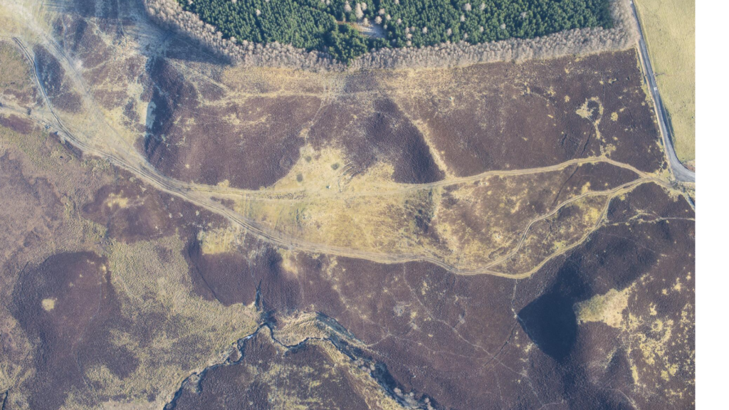
Upland Settlement
Early medieval domestic buildings were largely unknown archaeologically in mainland Scotland until the 1980s, when survey of north-east Perthshire identified a new and distinct building type: large, turf-built byre-houses (RCAHMS 1990). They survive in the upper zone of the uplands, and occur primarily in Strathardle and Glen Shee, with four principal groups at Balnabroich (RCAHMS 1990, 98–9), Knockali (RCAHMS 1990, 148–50), Lair (RCAHMS 1990, 150–2) and Pitcarmick (RCAHMS 1990, 75–8). The sites are commonly found to re-occupy sites of prehistoric settlement and activity, and do not tend to overlap later post-medieval ‘ferms’ and ‘fermtouns’. Excavations at Pitcarmick and Lair have since helped to characterise these building types.
The type-name was applied following excavations at Pitcarmick North by Barrett and Downes in 1993–5 (MPK2614; Carver et al 2013). Here, two houses were dated to the 8th–11th centuries AD. The elongated buildings, with their round-ends, were interpreted as byre-houses (see Building Traditions). Very few finds were recovered in context, although a stone pot lid, cannel coal bangle and animal bone were attributed to this phase.
Evidence of early medieval upland settlement was in fact first uncovered in 1987 when excavation of the large prehistoric hut circle group at Carn Dubh produced 7–9th century AD dates from the hearth of a sub-rectangular structure (MPK1752; Rideout 1996). This appeared to be an attempt to construct a rectangular building on the footings of an abandoned roundhouse. This resulted in a narrowing, slightly sunken form, with some similarity to the Pitcarmick-types, but much wider and more irregular in plan (Rideout 1996, 159).
The site at Lair, Glen Shee, identified as significant due to a potential sequence of successive Pitcarmick-types (RCAHMS 1990, 12), has since been more extensively studied with seven buildings excavated (Strachan et al 2019). This confirmed the introduction of the site type in the early 7th century AD. The development of this site type is clearly linked to the warming climate and can be seen as a purposeful reoccupation of a previously neglected landscape. The study also excavated the first building annexe, a characteristic of the type, and importantly identified early medieval buildings that were simpler than the classic Pitcarmick-type. These were interpreted as an integrated and prosperous farm complex comprising a byre-house and outbuildings. Pollen analysis confirmed the presence of both arable and pastoral upland economies.. A wider study suggested contemporary upland economic ‘recovery’ across Scotland. Lair appears to have been stable and productive until the 11th century when poorly understood change resulted in its demise.
The distribution of known Pitcarmick-types was influenced by the extent of the 1980s RCAHMS (1990) survey, and since then a number of possible examples have been recognised west of the River Tay. These include examples found amid recurrent settlement spanning the Bronze Age to the late 1st millennium AD in Strathbraan (Cowley 1997), at Griffin Wind Farm, sites 11, 19 and 25 (MPK7348, MPK7350 and MPK7345), Aberfeldy (Bailey 2014) and also possibly at Bunrannoch, Kinloch Rannoch (MPK237; MacGregor 2010). It is possible they were once ubiquitous across the region’s inhibitable uplands but further work is required to confirm examples outside the RCAHMS 1990 and 1994 study areas. Another potentially important site, on the terraces above the strath floor at Logierait (EPK1488), produced a number of early medieval features. These include a suite of 44 postholes representing structures occupied in the late 7th to late 8th centuries AD, a buried soil of late 8th or 9th century AD date, containing indirect evidence of ironworking, and ditched boundaries dated to 9th century AD (Ellis et al 2021).
Lowland Settlement
In contrast to the uplands, there is a lack of lowland settlement evidence both in this region and across most of lowland Scotland. At Easter Kinnear and Hawkhill, Fife, a series of sub-rectangular cropmarks were confirmed through excavation to be sunken buildings, around 10x7m long with rounded corners and stone wall footings. Evidence at the former produced up to three phases of activity including a remodelling into sub-rectangular timber buildings of earth fast timber and wattle wall construction, dated between the 6th and 7th centuries AD (Driscoll 1997).
It would be reasonable to assume that cropmark evidence should exist for early medieval structures in Perth and Kinross, but to date none is known. This in part may result from the nature of the largely turf construction with minimal, if any, cut features, so easily removed by the plough and leaving no diagnostic cropmarks. It is possible that the lowland equivalent of the Pitcarmick-types may be identified as cropmarks by their sunken interiors, appearing as simple, straight linear features around 10–20m in length (Halliday pers comm).
One of around 60 palisaded enclosures, almost all known as cropmarks, has been shown to be early medieval through excavation. Upper Gothens (MPK5496), Meikleour, was explored on the basis of the coincidence of a lithic scatter and an irregular, sub-circular enclosure, assumed to be Neolithic (Barclay 2001, 35). It produced dates of the 9th–13th centuries and was shown to be a potentially high-status site associated with metalworking (Barclay 2001, 43). It indicates the potential for the identification of enclosed settlement for the period.

This paucity of earthwork and cropmark evidence makes the identification of early medieval settlement and activity through programmes of excavation on multi-period sites all the more vital. At Bertha Park, Perth, activity spanning the Neolithic to early medieval period identified in 2013–14 was further excavated in 2016 (MPK20178-88; Engl 2020). The majority of the excavated structures were interpreted as representing the truncated remains of an early medieval farmstead and its ancillary structures occupied between the late 7th to 12th centuries AD. Features excavated included a rectangular post-built structure, two posthole/pit alignments, a posthole/pit group, and a large pit containing articulated cattle bone (MPK20180). The post-built structure, measuring around 10.5x6m, may be similar to the sub-rectangular domestic structures at Easter Kinnear, Fife (Engl 2020, 18). It may also have parallels with later sites at North Scotstarvit, which dates between the 11th and 13th century AD (MacGregor 1998), and Newbarns, Angus, dating from the 8th–11th centuries AD (McGill 2004; Dunwell and Ralston 2008).
While no structural settlement evidence was found at Newmill West, the A9 dualling programme between Luncarty and Pass of Birnam saw the excavation of a grain drying kiln dated to AD 421–547 (MPK2331; Wilson and Clarke 2019). Cereal drying kilns are known in association with sub-rectangular domestic structures, such as that at North Scotstarvit in Fife (MacGregor 1998). While North Scotstarvit is later (AD 1043–1282), it suggests the Newmill kiln as a proxy for settlement in the area, further evidence of which might survive beyond the limited area evaluated as part of the A9 development.