At the beginning of the post-medieval period, South East Scotland already had significant links with Continental Europe. During the 17th and 18th centuries the region also became part of global trade networks, as Britain’s colonial expansion encouraged connections with Asia, Africa, and the Americas. Timber, ceramics, foods, and textiles travelled thousands of miles to meet the demands of Scottish consumers. Within the British Isles, the union of the crowns in 1603 and the act of union of 1707 fostered exchange between Southern Scotland and England, as many of the old political and economic barriers to cross-border contact were removed. However, the short and long-term economic ramifications of the union for Scottish trade and industry are contested by researchers.
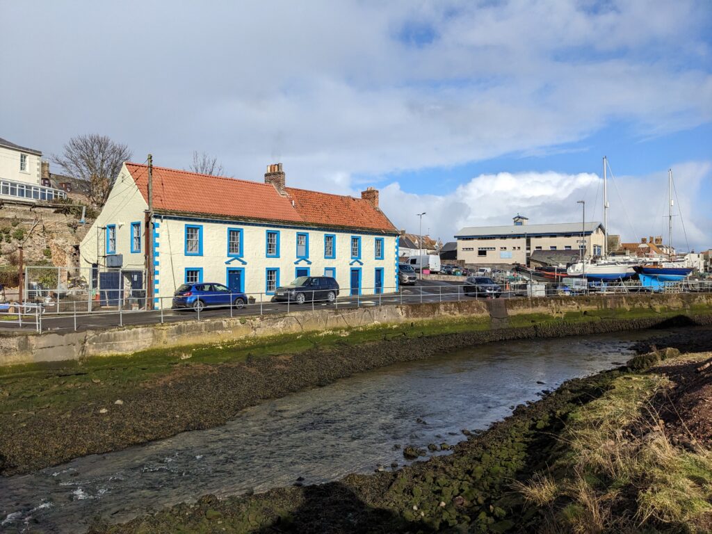
Sea travel was central to post-medieval international trade, and played a considerable role in the movement of goods within and outwith Scotland. In general, bulky cargoes such as grain, coal, or stone were more easily transported by water than land. As a result, the 17th and 18th centuries saw efforts to expand existing harbours and to establish new ports along the coast, from the Firth of Forth down to Berwickshire. Many traditional harbours were remodeled during this period, with 18th-century redevelopment at major ports such as Leith and at smaller harbours such as Eyemouth. An initial survey of historic East Coast harbours was conducted by Angus Graham in the 1960s (Graham 1969). However, further research at many of these sites would be desirable – especially as the growth in extreme weather events means that historic harbour works are at increasing risk of storm damage.
| Harbour (In Order Around Coastline from NW to SE) | Date Established | Council Region | National Grid Reference [N.B. These may differ from Graham] |
| South Queensferry | Medieval | City of Edinburgh | NT130785 |
| Cramond | Roman [Possible] | City of Edinburgh | NT189770 |
| Muirhouse | Before 1700s | City of Edinburgh | NT209770 |
| Newhaven | 16th century | City of Edinburgh | NT254771 |
| Leith | Medieval | City of Edinburgh | NT270764 |
| Portobello | c.1780 | City of Edinburgh | NT305744 |
| Fisherrow | 16th century | East Lothian | NT334730 |
| Musselburgh | c.1710 | East Lothian | NT348732 |
| Morrison’s Haven | 16th century | East Lothian | NT372738 |
| Cockenzie | 16th century | East Lothian | NT398756 |
| Port Seton | c.1640 | East Lothian | NT405759 |
| Aberlady Bay | Medieval | East Lothian | NT460801 |
| North Berwick | Medieval | East Lothian | NT553855 |
| Castleton | Medieval | East Lothian | NT594850 |
| Belhaven | Medieval | East Lothian | NT662784 |
| Dunbar | 16th century | East Lothian | NT681792 |
| Skateraw | 17th century anchorage. Harbour built c.1800. | East Lothian | NT738754 |
| Eyemouth | Medieval | Borders | NT945645 |
A wide range of goods were imported to South East Scotland from overseas. Evidence from urban sites indicates that even at the start of the post-medieval period pottery from a range of sources was entering the region. For example, excavations at Marlin’s Wynd in Edinburgh produced early 17th-century ceramics from Germany, the Low Countries, France and Iberia. A fragment of Chinese Late Ming porcelain was also discovered at Marlin’s Wynd, in a context which suggests that it was deposited before 1640. Dendrochronological evidence similarly provides evidence for ties between the South East of Scotland and the wider world. Throughout the 17th century timber was routinely imported from Scandinavia. Meanwhile, the 18th century saw the beginning of the use of American oak in building work in the region. Further research into the international goods imported to the region and the ways in which they were dispersed into communities beyond the major ports would be of interest. More comparative projects examining artefacts with international connections from a range of different sites and collections would be helpful.
During the post-medieval period significant numbers of people moved into and out of South East Scotland. The 17th and 18th centuries saw significant voluntary and involuntary emigration from South East Scotland both to Continental Europe and the Americas. For example, Scottish prisoners from the Battle of Dunbar in 1650 were sent as indentured labourers to New England. During the 17th and 18th centuries enslaved people were brought from Africa and the Caribbean to Edinburgh and other parts of the region. Although the east coast ports were not as central to the Trans-Atlantic slave trade as Glasgow, black servants and slaves do occur in records from Edinburgh, and occasionally in documentation relating to other burghs and elite residences in the region. Some imported products such as sugar, cotton, and tobacco also had links to slavery. Further study regarding sites and artefacts associated with slavery should be undertaken.
The South East of Scotland’s internal trade networks and transport routes likewise need more research. The 17th and 18th centuries saw efforts to improve transport within the region. Among other developments, the period saw significant investment in bridges. Many existing bridges were updated and new crossing points were established. A degree of research has been undertaken regarding the region’s major stone bridges, but much more could be done. In particular, further study regarding the relationship between post-medieval bridges and earlier crossings (both older bridges and fords) would be helpful. The recent Ancrum Old Bridge Project revealed timbers associated with the medieval bridge alongside the 18th century stone bridge and the modern crossing for the A68 – a reminder of the varied remains which can sometimes survive quite close to current transport infrastructure.
| Bridge (Ordered Alphabetically) | Date Built | No. of Spans | Council Region | National Grid Reference |
| Ancrum Old Bridge | 18th Century | 3 | Borders | NT639238 |
| Begbie Bridge | Late 18th Century | 1 | East Lothian | NT443668 |
| Bilsdean Bridge | 18th Century | 2 | East Lothian | NT763725 |
| Chirnside Bridge | Mid-18th Century | 3 | Borders | NT852562 |
| Coldstream Bridge | 1760s | 7 | Borders | NT849401 |
| Drochill Bridge | Late 18th Century [Probable] | 1 [plus small additional arch over lade] | Borders | NT163429 |
| Drygrange Bridge | 1770s | 4 | Borders | NT576347 |
| Earlston Old Bridge | 18th Century [Probable] | 2 | Borders | NT571382 |
| Ettrick Bridge | 1780 | 1 | Borders | NT390243 |
| Eyemouth Bridge | Late 18th Century | 1 | Borders | NT943647 |
| Galadean Bridge | Late 18th Century | 1 | Borders | NT559432 |
| Howden Bridge | 1760s | 2 | Midlothian | NT061672 |
| Leitholm Bridge | Late 18th Century [Probable] | 1 | Borders | NT787440 |
| Lyne (Bridge over) | Late 18th Century [Probable] | 1 | Borders | NT186407 |
| Lyne Station Bridge | Late 18th Century [Probable] | 2 | Borders | NT209401 |
| Manor Water Bridge | 1700s | 1 | Borders | NT232394 |
| Newcastleton Bridge | 1790s | 2 | Borders | NY482869 |
| Newmills Bridge | Late 18th Century [Probable] | 1 | Borders | NT526497 |
| Newmills Bridge | 1750s | 3 | Midlothian | NT329676 |
| Old Bridge, Innerleithen | 1700s | 1 | Borders | NT333372 |
| Preston Bridge | 1770s | 3 | Borders | NT787568 |
| Romanno Bridge | 1770s | 3 | Borders | NT159480 |
| South Bridge | 1780s | 19 | Edinburgh | NT260736 |
| Swintonmill Bridge | Late 18th Century [Probable] | 3 | Borders | NT813461 |
| Toftbarns Bridge | Late 18th Century | 2 | Borders | NT539262 |
| Tower Mill (Bridge Near) | 17th or 18th Century | 2 | Borders | NT502144 |
| Trow Mill Bridge | Late 18th Century | 1 | Borders | NT533168 |
| West Saltoun | 18th Century | 1 | East Lothian | NT458669 |
| Yair Bridge | Mid 18th Century | 3 | Borders | NT458325 |
Bridges were of course part of a wider network of roads and tracks. In the early and mid-20th century a degree of research was undertaken regarding several older routes through the region (Inglis 1916 and 1924; Graham 1964). Some of this work indicated that the 18th century was a time of change in the region’s roads. However, there is room for more consideration of the question of post-medieval roads in the region. In particular, there is potential for considering the nature of the region’s roads in the 17th century and the efforts made to maintain and improve them. Sections of cobbled roads and other forms of track are uncovered relatively frequently, but there has been few recent attempts to link up these findings to develop an overview of land transport in the region.

South East Scotland appears to have seen several innovations regarding transport during the post-medieval period. Supposedly, the first workshop building coaches in Scotland was established in Edinburgh in the 1690s. The use of coaches then expanded significantly during the 18th century (Bremner 1869, 109). One of the region’s most remarkable post-medieval transport developments was the horse-drawn railway which brought coal from Tranent to the salt pans at Cockenzie. Recent commercial and community archaeology work indicates that this structure underwent several phases of development between its creation as a largely timber structure in the 1720s and its conversion to iron rails in the early 19th century.

In general, there is potential for much more study of the region’s post-medieval wheeled vehicles, and how their use interacted with other forms of transportation, including pack horses and sledges – which documentary evidence suggests were frequently used to transport loads in Edinburgh and the countryside into the 18th century. Integration of evidence from images and documents, with the physical remains of tracks, bridges, and occasionally fragments of vehicles, could provide valuable insights into post-medieval land transport in the region.