Background
The nature of conflict between the indigenous peoples and Roman invasion forces in south east Scotland remains a matter of debate (Hunter 2007; Harding 2017) but was likely to have been multifaceted, with a complex interplay of pre-existing tribal rivalries, Roman expansionism, resistance movements, cultural clashes, economic struggles and occasional periods of cooperation. The historical landscape of south east Scotland is littered with outstanding evidence of multiple episodes of Roman incursions but with no convincing evidence of acculturation or civic development. These conflicts — the duration of which also remain enigmatic – shaped the region’s history and had a lasting impact on its cultural and political landscape, ultimately helping set the stage for the broader historical narrative of Scotland.
The south east would have been one of the main points of first contact, particularly along the route of what was to become known as Dere Street. The resulting series of Roman forts of control, from Corbridge to Newstead and northwards towards the Forth, represent sites of prime interest and would benefit from further study, especially dating of their multiple destruction deposits. Similarly, study of destruction deposits in native homesteads and hillforts in this same zone of contact would help date periods of occupation and desertion in relation to the Roman presence. Specifically, the nature of Roman interaction with the local power centres of the Border’s brochs (Bow, Torwoodlee and Edin’s Hall) requires further examination and synthesis. Were these defensive and monumental structures destroyed by the Roman Army in a single or multiple episodes, or by inter-tribal warfare and is it possible to differentiate? Further afield from these centres, serendipitous finds by agricultural activity or metal detecting can also shed light on the interaction that will undoubtedly have taken place in the region.
Military Equipment
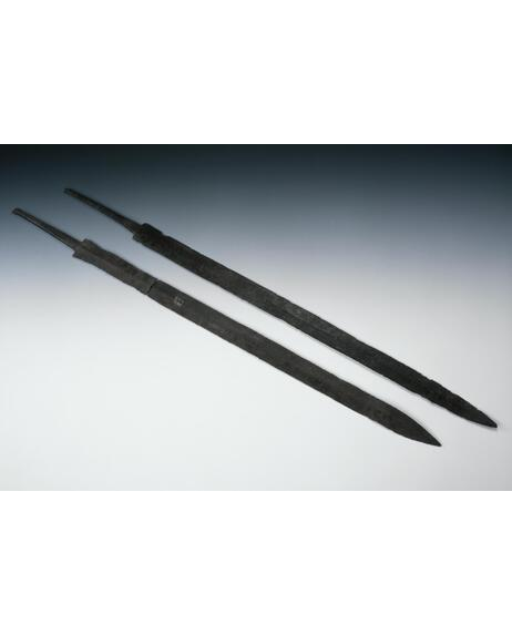
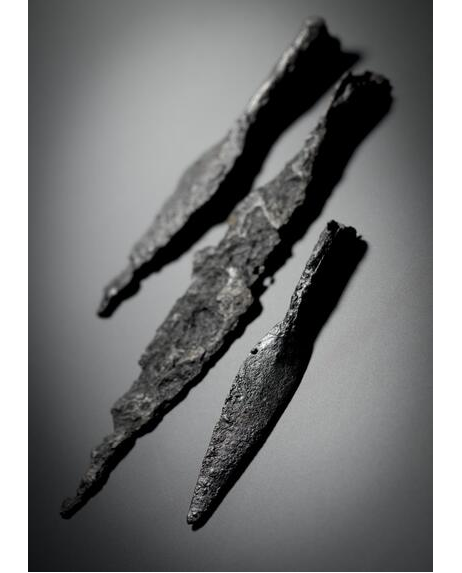
Many of the items from previous excavations at Newstead (Curle 1911) are directly related to the offensive capability of the Roman Army, from swords, spears and missiles to cavalry fittings. Most weapons are of iron construction and as such do not fare well in Scottish soil when not in anaerobic conditions. Lead sling bullets on the other hand, do survive with little degradation and may be useful in identifying sites of conflict e.g. Burnswark Hill in Dumfriesshire (Reid and Nicholson 2019). Some bullets have been recovered from Newstead and along the line of Dere Street, but no systematic search has been made for these missiles at non-Roman sites. It has been suggested that identification and plotting of bullet scatters may in future help identify zones of conflict (ScARF 2012, 31).
Roman Coins
More than forty hoards of predominantly silver Roman coins have been found across Scotland (Blackwell 2017) and many, if not most, of these represent attempts at Roman hegemony in the second and third centuries. Some of these hoards have been discovered relatively recently and may specifically relate to the aftermaths of, or preludes to, the Commodan and Severan expeditions (Holmes 2015). Further coin discoveries have been made by detectorists throughout the SE region and since most silver coinage was likely sourced from Roman military personnel, the distribution of these coins is of relevance when assessing the reach of Roman patrols or control networks.
Battlefields and Siegeworks
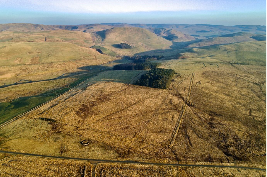
No siegeworks, as exemplified by Burnswark, have been definitively identified in south east Scotland though it had been previously suggested that the linear earthworks at Woden Law were indicative (Richmond and St Joseph 1983). Whilst these have now been redefined as native territorial boundaries, it is likely that during some of its many incursions, the Roman Army was engaged in offensive activity against indigenous fortifications. Reassessment of LiDAR data of the perimeters and environs of indigenous settlements along the likely routes of advance of the Roman Army may shed new light on episodes of conflict. Serendipitously metal-detected sling bullet scatters may also be helpful here.
Interaction
The pattern of interaction between Romans and the indigenous Iron Age population would have been flexible, contextual and fluid. The ScARF Roman Chapter draws attention to many of the issues of negotiating social identities in a changing world. A large number of the key settlements, and the local and regional social groupings that they reflect, were situated both inside and outside of the Roman Empire at different periods. Key sites with more extensive excavation may be key to understanding these relationships. Broxmouth Hill is the most extensively excavated (Armit and McKenzie 2013). Traprain Law at times certainly had close contact, which can be seen through evidence of Roman goods and trade. The last defensive works on the site were constructed during the late Roman Iron Age for example Cruden Wall. (Erdrich et al. 2000). From the perspective of understanding the Roman presence in south east Scotland, additional work at Iron Age sites will be extremely valuable.