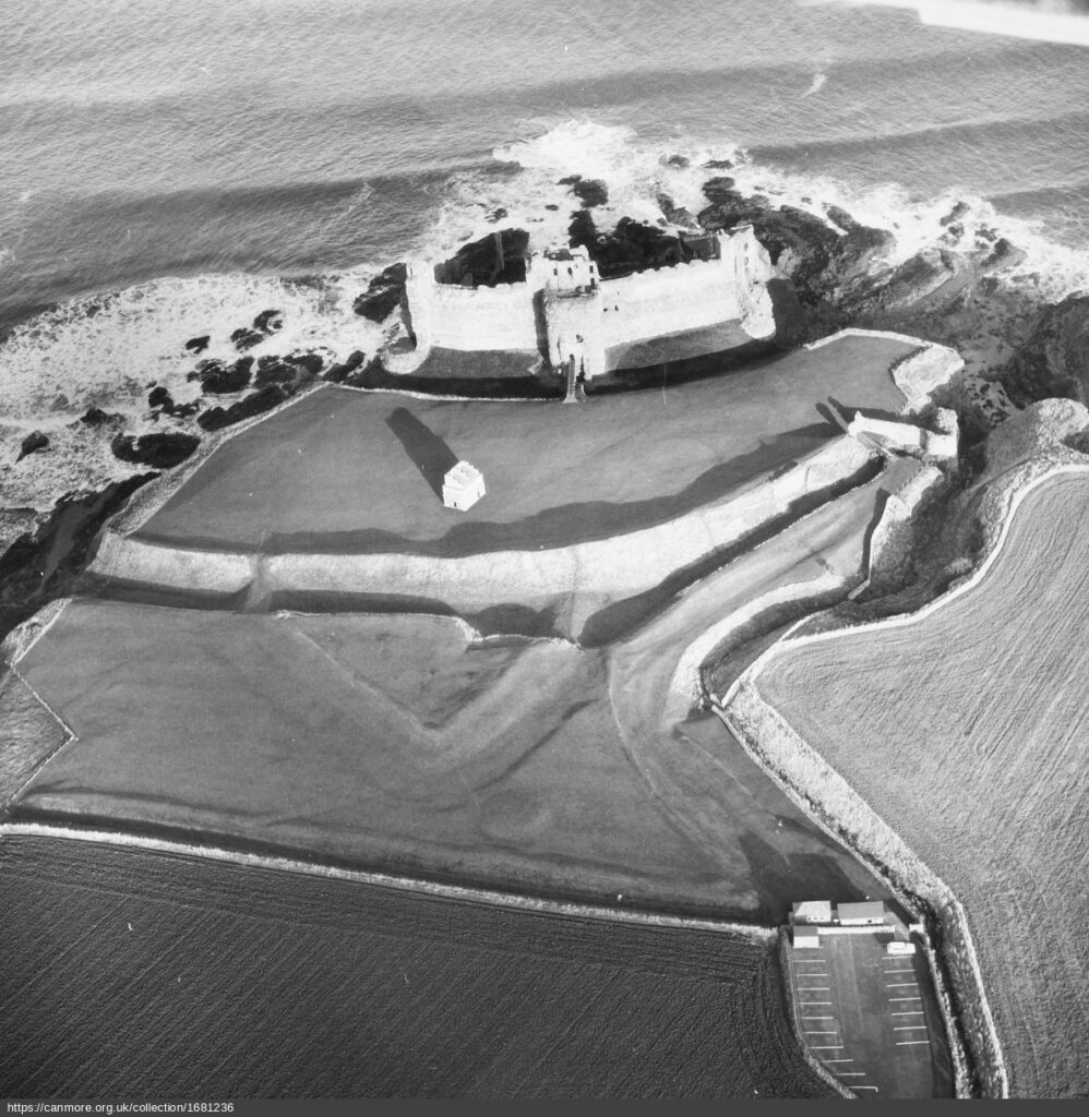
The post-medieval period saw significant changes to fortifications in South East Scotland. The greater use of artillery weapons in the 17th and 18th centuries meant that traditional tower houses and castles declined in military effectiveness. By the late 17th century these structures had largely ceased to be built. However, a number of existing castles and tower houses in the region did see military action during the 17th century – particularly in the Wars of the Three Kingdoms. For instance, excavations at Tantallon Castle have revealed siegeworks and defensive earthworks probably relating to the Cromwellian siege at the beginning of the 1650s (Ewart 2016). More research regarding the ways in which medieval fortifications were used and adapted in South East Scotland during the post-medieval period would be desirable. Improved understanding of the processes by which some older fortifications were abandoned and destroyed in the 17th century would also be beneficial.
The 17th and 18th saw major remodelling of a limited number of earlier fortifications. Notably, Edinburgh Castle saw substantial new artillery defences, particularly on the eastern approach to the castle. An ambitious programme of research led by Historic Environment Scotland has cast new light on the complex post-medieval history of Edinburgh Castle’s defences and the way in which late 16th century bastions were altered and added to during 17th and 18th centuries. Many of these structures did in fact see military action, with Edinburgh facing major sieges in 1640, 1650, and 1689, as well as brief periods of conflict in 1715 and 1745. The siege of 1689 saw extensive siegeworks, with the attackers constructing several batteries and draining the Nor Loch – activities which may well have left archaeological remains.
Further afield in the Edinburgh area, it is possible that traces might be found of the earthworks constructed by David Leslie in 1651, which stretched from Edinburgh to Leith, probably running along the line of what is now Leith Walk (Furgol 2002, 66). The post-medieval remodelling of Leith’s urban defences might also benefit from further research. Much of the previous consideration of Leith’s defences has focused on the siege of 1560 (Pollard 2008; Paton and Cook 2016). However, the defences of the port and its environs also saw successive phases of development during the 17th century. Meanwhile, the 1650s also saw the construction of a Cromwellian citadel by the shore. Archaeological work in the 2000s uncovered parts of the post-medieval ditches associated with the citadel, but further research regarding this site might be possible (Stronoch 2002).
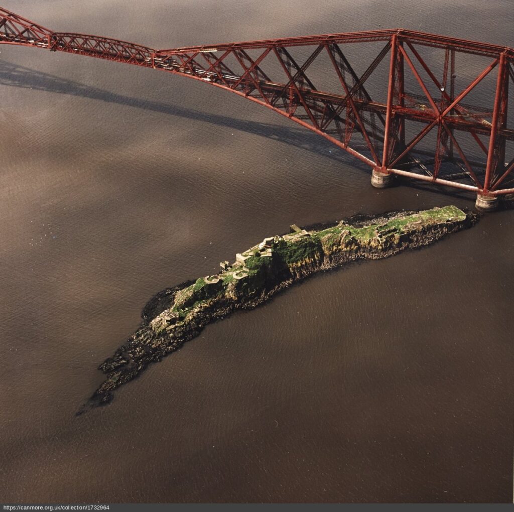
A number of post-medieval fortifications were sited in locations which retained a military significance into the 19th and 20th centuries. For example, the island of Inch Garvie saw the construction of significant fortifications in the period immediately preceding the Wars of the Three Kingdoms. These defences were used by Royalist forces during the Cromwellian invasion at the beginning of the 1650s. However, the island also saw military occupation during the Napoleonic Wars and both World Wars, as well becoming part of the foundations for the 19th-century Forth Bridge. These subsequent phases of activity profoundly altered the structures on the island. Nevertheless, elements of the post-medieval fortifications are thought to be built into the twentieth-century concrete defences. It is possible that at a number of sites in the region modern military buildings may obscure or stand adjacent to post-medieval defences.
In addition to actual fortifications, the post-medieval period also saw the construction of numerous barracks in South East Scotland. Indeed, the City of Edinburgh historically had the largest number of barracks of any region in Scotland outside of the Highlands. Many of these sites experienced major redevelopment during the modern period. However, at some locations, such as Edinburgh Castle, significant 18th-century barracks survive relatively intact. There are also some demolished barracks which are on sites which have seen limited subsequent building. For example, LiDAR data has indicated the probable location of the 18th-century Baro Barracks in East Lothian, which appears to have stood in open country beside the modern B6370 road. Further research into this wider military infrastructure would be desirable.