British references to the Antonine Wall begin to appear in the historical literature from the 6th century AD. Gildas correctly identified two Roman walls, one of turf and another of stone, though he dated them to the end of the fourth century, reversed their chronological sequence and ascribed the turf wall to local construction (De Excidio 15–18). Bede localised the turf wall to the Forth-Clyde isthmus using contemporary spatial terms (between Abercorn and Dumbarton) and adjusted the dating to the early 5th century AD (Hist. Eccles. 1.12). Aware of classical accounts describing a wall built by Severus, however, he referred to three walls.
A Severan wall – certainly Hadrian’s Wall – was mentioned in a work traditionally ascribed to Nennius (Hist. Britt. 23), but a marginal gloss probably from around AD 1200 in certain manuscript copies placed it on the Forth-Clyde isthmus, adding that it was rebuilt by the usurper Carausius in the late 3rd century AD. Also included is an allusion to Arthur’s O’on, a Roman temple that once stood on the banks of the River Carron (see Extramural activity). Around 1250, Matthew Paris produced four maps of Britain (published by the British Museum in 1928), the most detailed depicting two walls, with the northern wall often identified as the Antonine Wall.
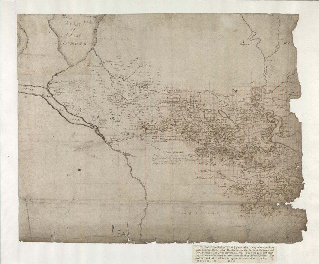
John of Fordun, a 14th-century chronicler, provided the first Scottish account, suggesting that Julius Caesar camped on the Forth and constructed Arthur’s O’on (Chron. Gent. Scot. 3). He otherwise followed Gildas’ narrative, while offering a new perspective on events between the construction of the walls around the beginning of the 5th century AD in which a figure named Gryme, a Briton and grandfather of King Eugenius who had been expelled from his territory for abetting the Scots, gathered forces to reclaim his former lands, breaking through the turf wall (Skene 1872, 81–2). This is the origin of the name Grymisdyke, or Graham’s Dyke, for the Antonine Wall. Fordun’s narrative influenced later historians, including Hector Boece and George Buchanan in the 16th century, though the then-recent rediscovery of classical works raised important questions. Buchanan is credited with being the first to use the evidence of inscriptions and standing remains, following which the Antonine Wall was first mapped in detail by Timothy Pont between 1583–96.

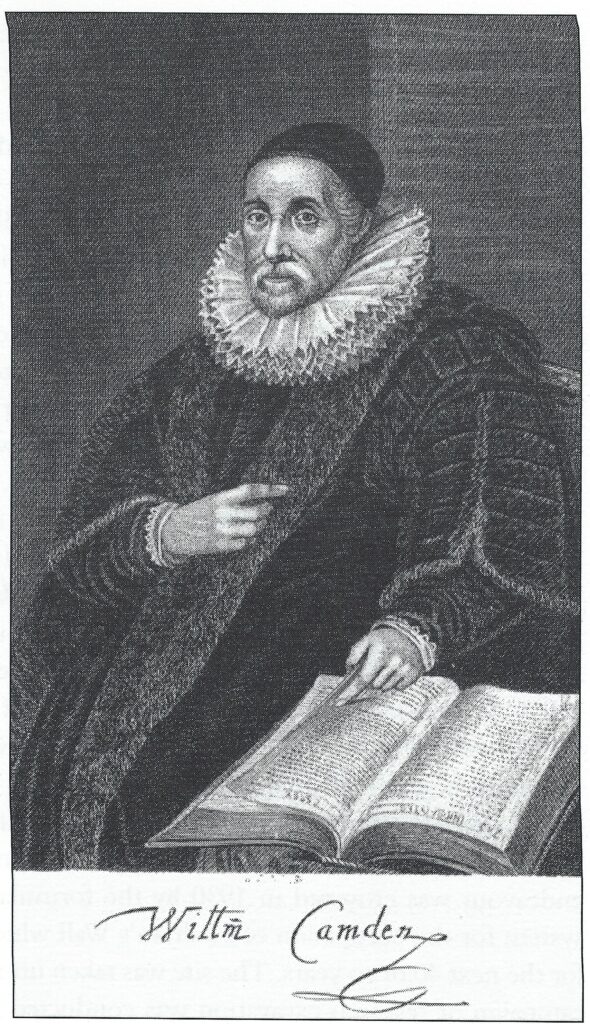
The Renaissance also saw the rise of chorographer-antiquarians (Rohl 2011), the best-known being William Camden (1551–1623), who was first to correctly attribute the Wall to Antoninus Pius on the basis of inscriptions. A range of antiquaries visited and investigated the Wall, particularly in the period 1700–40. Important figures include Robert Sibbald, John Clerk, Alexander Gordon and John Horsley, though they were supported by a number of informants and correspondents (Keppie 2012). These contributions remain relevant, as evidenced by Horsley’s bold hypothesis that the Wall featured 19 forts at intervals of about two Roman miles. Important developments in the latter half of the 18th century include William Roy’s military survey and his study of the Roman remains in Scotland (1793), the construction of the Forth and Clyde Canal and James Macpherson’s publication of the Poems of Ossian (1765), purportedly an authentic oral tradition from the 4th or 5th centuries AD. Writings into the 19th century are characterised by tension between Ossian-inspired Caledonian romanticism and the more rational evidence-based approach of most 18th-century antiquaries.
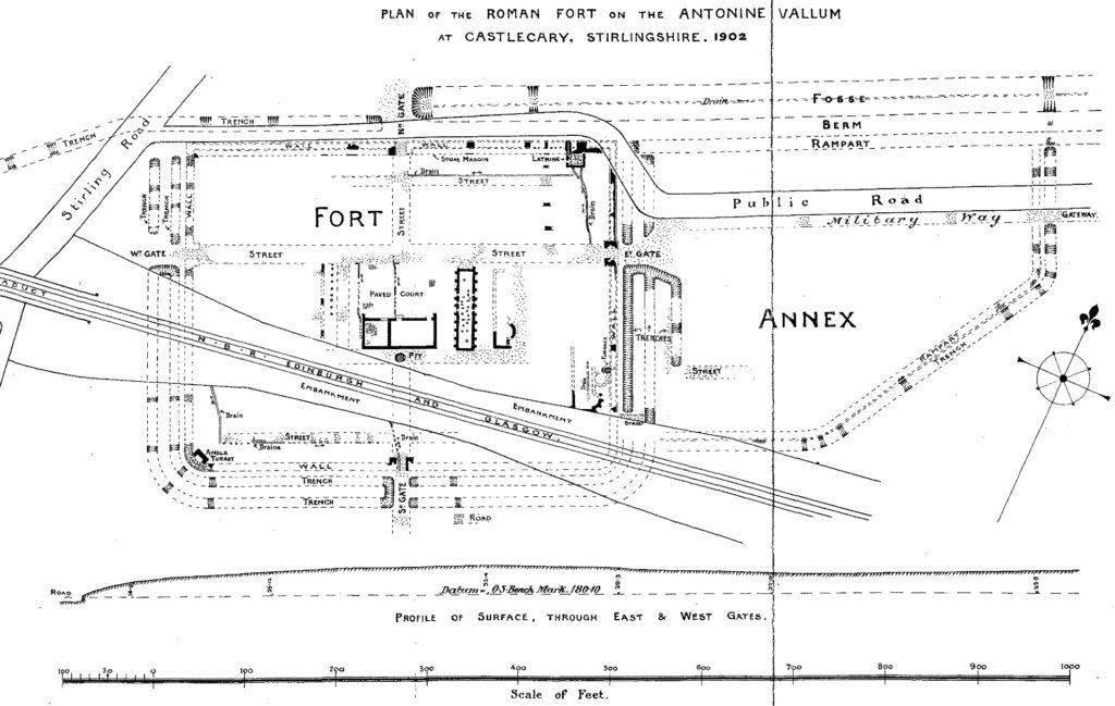
The 19th century saw the transition from antiquarian modes of investigation to systematic archaeological excavation. Increased development and land improvement continued to uncover and destroy remains, prompting work by John Buchanan and Robert Stuart. Towards the close of the century, the Glasgow Archaeological Society and Society of Antiquaries of Scotland commenced the first systematic excavations of the Wall and its forts (eg GAS 1899; Christison et al 1903; Buchanan et al 1905). These revealed much evidence and also raised a number of questions and problems that remain important today, such as the original height of the rampart, the role of the berm, the function of expansions and of annexes.
Keppie (2012) summarises these accounts and the development of knowledge from the Roman withdrawal to the first edition of Macdonald’s synthesis (1911). The summary highlights the under-explored breadth of pre-20th century speculation and scholarship, introduces previously unknown accounts and antiquarians, and will hopefully stimulate further research.
Research Issues
- Encourage historians and literary scholars to search for further accounts relating to the Antonine Wall through archival research, including estate papers and newspapers, bearing in mind that some relevant material may be held in records outside Scotland.
- Undertake a new examination of antiquarian maps and assess how they may contribute to archaeological research.
- Encourage historians and literary scholars to untangle the Wall’s role in mythic landscapes from the early medieval period to the aftermath of Macpherson’s Ossian.