OS data © Crown copyright, Database Right (2022), and OS Terrain 5, OS Terrain 50, OS OpenMap – Local & Strategi right (2022) (CC BY-NC-SA)
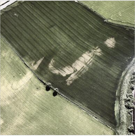
Two groups of fortlets have been identified – Glenbank, Kaims Castle (MPK675; Christison 1901, 18ff) and Midgate (MPK5642; Christison 1900b, 32ff; Woolliscroft 1993, 302ff) and two slightly larger installations – Inverquharity and Cargill (MPK5454). The first group consists of a small bank and ditch enclosure, with no evidence of internal structures beyond a gravelled surface (Woolliscroft and Hoffmann 2006, 87–8). The small forts at Cargill (Woolliscroft and Hoffmann 2006, 150) and Inverquharity (Woolliscroft and Hoffmann 2006, 165–7) are somewhat larger but have only been investigated from the air (Maxwell and Wilson 1987, 15) and through geophysical survey.