The following sections will briefly review the various types of fieldwork methodologies that have been utilized to recover Mesolithic sites in Scotland, while for Palaeolithic sites methods used in England and Wales will be discussed.
Desk-Based Assessments
There are significant challenges accessing raw data in SMRs/HERs, on both a national and local level, for known Mesolithic sites (see the ScARF download: SMR and NMRS issues). Because they often exist only as artefact scatters, even if those have been securely identified as Mesolithic, sites are not always recorded as such. Valuable information relating to individual sites is often only available within larger reports (relating to major fieldwork projects) and in the ‘grey literature’ pertaining to developer-funded archaeological fieldwork. There is also a problem of misidentified Mesolithic sites in the records, as when, particularly in the older literature, artefacts have been incorrectly described as ‘microliths’. Generally speaking, most of the evidence for the Mesolithic period available from museum and private collections is not recorded in SMR/HER databases.
Aerial Photography
The identification of Mesolithic sites using oblique aerial photography has not been adequately addressed. There has been the occasional instance where coherent Mesolithic remains have been found in crop-marked landscapes such as Newton on Islay (McCullagh 1989), at Dunbar Cement Works (Gooder and Hatherley 2003), and at Crathes, near Banchory (Murray et al.2009). This indicates that with optimum conditions early prehistoric sites may be visible as cropmarks on the aerial photographic record of Scotland and it may now be possible to begin to see whether there are any diagnostic features in the relevant cropmark records that can be recognised as potentially diagnostic of Mesolithic activities. New developments in aerial reconnaissance, for example using LIDAR, may have implications for Palaeolithic and Mesolithic research (see papers in Cowley 2011).
Geophysics
Geophysics is currently rarely used in Mesolithic and Palaeolithic research. However, pilot studies have been undertaken at several sites in Scotland (Finlay and McAllen 2004) to investigate the extent of shell-midden sites, while some encouraging results were obtained at Howick, Northumberland, where the remains of a large structure of Mesolithic date had been identified (Waddington 2007). A similar roundhouse structure was also revealed using geophysical survey and excavation at East Dunbar (Gooder and Hatherley 2003). The application of geophysical survey techniques for the identification of Mesolithic features is generally an untested method in the British Isles, but has great potential and significant implications for future investigations of such sites (see papers in Cowley 2011).
Pollen Analysis
There have been many instances where pollen analysis has suggested the presence of hunter-gatherers in the landscape, but where no archaeological evidence has as yet been recovered in the vicinity to underpin this interpretation (Edwards 1990; 1995; 1996b; Whittington et al. 1990). Unfortunately, this type of data is not readily available to the curators of SMRs and HERs, making it difficult to identify areas where they might wish to request a Mesolithic dimension to any archaeological investigation should development be proposed. Pollen data can also be difficult to interpret, e.g. to what extent the locations of such data indicate a settlement pattern that is topographically coherent and which can then be used to suggest areas for curatorial intervention. Such indicators are probably only going to reveal traces that could be satisfactorily tested by a large-scale project that would require a systematic test-pitting regime (Finlayson et al. 2004).
Fieldwalking
Fieldwalking of ploughed areas remains a relatively economical way of locating sites and has been one of the main methods of finding Mesolithic sites (and one Palaeolithic site) in Scotland, but this is constrained in some regions of the country by the availability of cultivated, or otherwise unvegetated, land. This is particularly the case along the west coast and within large areas of the hinterland and mountainous regions that comprise large tracts of peat-covered land, which has covered much of the early prehistoric landscape.
Ideal fieldwalking conditions include a combination of surface weathering, good light, and sympathetic weather, and without long-term access to an area it is difficult to optimise these variables at short notice. Furthermore, in many areas, fieldwalking opportunities are limited in time due to the requirements of intense sowing and crop-rotation schemes. Difficulties also surround the identification of sites through fieldwalking, where one visit is often insufficient to locate meaningful samples of lithic material. This is an effect of both the low density of material on some sites, and — it may be postulated — the small quantities of material that might be churned up by the plough to appear on the surface on any less damaged site. The value of repeat visits to walked fields has been confirmed by several large landscape-based projects (Mithen 2000, 157—62; Hardy and Wickham-Jones 2009; Ballin et al. 2010a; Ward 2010; Passmore and Waddington 2009).
The location of Mesolithic sites on high-quality agricultural land is sometimes a mixed blessing. Historically, ploughing and associated activities will have increased the chances of sites being identified, but these processes will also have contributed significantly to their likely degradation/destruction. Where sites are preserved, they may only survive within the ploughsoil in a significantly transformed condition. In such cases a range of lithic evidence can be described, but often with little or no reference to other surviving features; nor is any stratigraphic integrity preserved. An indication of the duration of a particular site versus its scale of occupation is thus rendered problematic. Furthermore, the reliance on fieldwalking of tilled fields as the main detection method for hunter-gatherer sites immediately creates a significant bias in the revealed distribution pattern.
One particular problem with the identification of hunter-gatherer sites within ploughsoil contexts, especially in valley bottoms adjacent to major river courses, is widespread soil displacement — either through natural erosion or the displacement of soils during the subsequent use and working of the land. In such circumstances, the chances of finding structural remains may well be minimal, even if the occasional artefact is discovered during fieldwalking.
Landscape Survey and the Upland Landscape
Traditional survey methods, including fieldwalking are hardly applicable in the upland zone at all; Mesolithic sites are simply not going to be revealed in general ground-perspective survey. At the same time, identifying Mesolithic sites in these zones remains a very important goal (cf. Donahue and Lovis 2006; Fojut 2006). Bang-Andersen’s approach for prospecting in similar environmental contexts in Norway (Bang-Andersen 1987) involved the excavation of vast numbers of shovel-pits (small test-pits) to locate artefacts. A similar approach was adopted in the Southern Hebrides Mesolithic Project and the Scotland’s First Settlers Project, although on a smaller scale, in areas where ploughing was absent. With this mode of survey it is important to understand the chronology of landscape formation in order to manage the survey effectively as well as interpret the results. This requires a battery of investigative techniques and an integrated approach in which the results of test-pit survey are assessed with a wider consideration of landscape history.
Forest planting, especially within the upland zones, has radically altered the landscape of Scotland (Foot 2003). Afforestation offers a series of archaeological potentials and problems (see papers in Trow et al. 2010). Woodland Grant Schemes and Environmental Assessments mean that forestry ploughing represents one of the few contexts in which large upland areas can be examined. The success of the exercises undertaken by amateur groups in South Lanakshire (Johnston 1997; www.biggararchaeology.org.uk) and recent discoveries in Caithness (Pannet and Baines 2006) demonstrate clearly the gains to be made from a more general examination of these areas, especially using systematic post-ploughing fieldwalking to recover lithic assemblages.
In the Pennines and the North York Moors of England, the examination of eroding peat hags has been important for locating Mesolithic artefacts in the upland zone (Spikins 1999). Spikins outlines potential influences on peat erosion in England, including pollution resulting from the presence of major industrial cities, while another is erosion caused by sheep sheltering from the wind; these latter scrapes creating an apparent preference in the distribution of Mesolithic sites for sheltered locations (Finlayson et al. 2004). Sub-peat Mesolithic sites have been successfully located in upland Scotland, in particular where lowered water levels in reservoirs and natural lakes have exposed archaeological material and old ground surfaces from which peat cover has been eroded (Affleck 1986; Ward 1995).
Coastal Survey
Within the coastal areas of Scotland, especially along the west coast, Mesolithic sites have been recovered along eroding shorelines, on raised beach terraces, within abandoned sea caves and rock shelters, and within the inter-tidal zone. Generally, these sites have been recovered by dedicated non-institutional archaeologists with a particular interest in the area where they live, and through the larger academic-led research projects. Local individuals and archaeological organisations may identify sites from small-scale erosional contexts for example, during repeated visits over a relatively long period of time.
Given the long-term nature of successful fieldwalking, it may also be appropriate to encourage such activities within the coastal zone, and not simply predominantly on arable land, as is presently the case. Shorewatch groups, for example, might agree to collect lithic artefacts in the course of their activities, including surveying eroding shorelines. This could significantly enhance the record in a potentially very significant zone, such as resulted from the surveys undertaken by the Scotland’s First Settlers Project (Hardy and Wickham-Jones 2009).
Intertidal and Underwater Survey

Multiperiod survey in the intertidal zone, Bay of Firth, Orkney © Rising Tide
It is important to note that around some of the Scottish coast relative sea-level rise since the early Holocene means that coastal settlement will have been submerged. The location and investigation of submerged Mesolithic sites brings its own suite of issues, addressed in a forthcoming volume edited by Fleming.
The exploration of the seabed has recently become a focus of research projects in the British Isles, looking at submerged archaeological sites and drowned landscapes (Dawson and Wickham-Jones 2009; Dawson 2009; Ballin 2008; Momber 2000: Gaffney et al. 2009; Bell and Neumann 1997; Bailey and Flemming 2008; Momber et al. 2011; Fleming 2004; Benjamin et al. 2011). This area of research and survey is still at an early stage in Scotland, although inter-tidal sites containing peat deposits and flint tools have been identified (Dawson 2009; Ballin 2008). Fieldwork undertaken elsewhere around the coast of the British Isles, some of which is taking place in advance of off-shore developments, is revealing significant results. In particular, geophysical surveys along with a wide range of finds lifted from the seabed by fishing and dredging activities are providing a better understanding of the settlement of the North Sea Plain prior to transgression by the sea (Gaffney et al. 2009). Work to focus on areas of preserved sediment as well as stony seabed is recommended.
Caves and Rock Shelters
A systematic examination of caves and rock shelters should be encouraged (Bonsall et al. 1991; 1992; 1994; Tolan-Smith 2001). Recent survey and excavation work by the Scotland’s First Settlers Project has provided a wealth of evidence to suggest that these natural features in the west of Scotland have a high incidence of use in many periods (Hardy and Wickham-Jones 2009), and although later activity may mask, or have destroyed Mesolithic use, survey of these sites has to be accorded a high priority. With regard to Palaeolithic settlement in Scotland, the investigation of caves, in particular deep caves and caves sealed with glacial sediments provide one of the best opportunities for recovering evidence pertaining to these early periods of Scotland’s past. Opportunities for exploring such cave and rockshelter sites have often been lost because their presence has only been revealed in the course of development, the sites being previously masked by scree etc., as at Kilmelfort Cave, Argyll (Saville and Ballin 2009). Advantage should be taken of new ground-penetrating techniques for scanning and probing hillslopes where caves and rockshelters may lie hidden, and closer links with the cave exploration community in Scotland should be established and maintained. Survey in particular areas, such as in north-east Scotland (Fojut 2006, 71), could be prioritized.
Research Excavations
The investigation of early prehistoric sites poses unique problems and possibilities, and requires the adaptation of standard methods of excavation. Although a consistent approach to excavation in the field needs to be adhered to, methodologies often have to be tailored to suit specific site requirements. This is certainly the case when working on Mesolithic sites within the varied landscapes of Scotland where unique problems have to be addressed to answer specific research criteria. The need for consistency in recovery and recording methods should always be considered during any excavation, a factor that should be carried through to the post-excavation stages of any project.

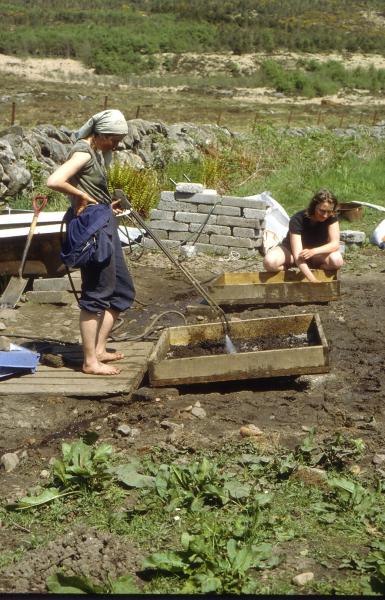
Test pitting at the Tanged point site, Millfield, Stronsay © Caroline Wickham-Jones
Test-pit surveys, trial trenches and open-area excavations are all methods through which Mesolithic sites have been investigated in Scotland (Hardy and Wickham-Jones 2009; Mithen 2000; Finlayson et al. 2004). Usually, with the investigation of unknown and newly-discovered lithic scatter sites, whether revealed through fieldwalking or other means of identification, a series of test pits can be opened to plan artefact distributions and to assess the character of the site with regard to potential of trial trenching and / or area excavation — especially in light of potential in situ remains and features. However, there are two critical decisions that need to be made with a test-pit survey of this type, including the size of the individual test-pits and their distance apart (Mithen 2000). The great benefit of undertaking a test-pit survey of a site is the spatial control over the recovered data, allowing the production of artefact distribution maps, which can then be used for planning the resulting excavation strategies — if this is deemed necessary.
Problems arising from test-pit excavation of sites include the overall difficulties in recording soil/sediment profiles due to the potential depth and size constraints of the excavated area, the labour—intensive costs of recording all recovered artefacts in 3D, and making a decision as to whether wet or dry-sieving of all of the recovered deposits is feasible.
Depending on the results of the test-pit evaluation of a given site, it should then be possible to make informed decisions on how to proceed with further excavations — whether through trial-trench excavation or using open-area excavation. At sites with deep sediment profiles, trial trenching can be used successfully to expose long continuous stratigraphic sections that were difficult to record using test-pits, while also allowing the exposure of larger areas of relevant archaeological contexts with the help of locating features. A 100% wet-sieving strategy should be used where possible during trial-trench excavations in order to provide an unbiased sample of lithic assemblages from exposed contexts. A 3mm wire-mesh sieve should be used to recover this material (or using a smaller mesh sieve and flotation unit, especially if plant remains and other environmental data are expected to survive). Using a high-pressure hose may be required if the sediment is expected to clog the sieve, but alternative sampling strategies may have to be employed for more delicate remains due to the potential damage that could result from the high-pressure water supply to the hose. Where possible, flots and wet-sieve residues should be air-dried prior to sorting. This has been shown to assist significantly with recovery of materials from the residues (Mithen 2000, 59; Hardy and Wickham-Jones 2009).
If the results of test-pit and / or trial-trench excavation reveal dense artefact scatters or areas of known foci within a site, then open-area excavation may be a method to evaluate the site further. This often involves the exposure of a substantial area of archaeologically relevant contexts followed by a detailed and systematic excavation strategy. The individual recording of artefacts can be undertaken using 3D-plotting in relation to quadrates and either stratigraphic context or a specific spit within a context. However, if time constraints have to be taken into consideration, then recovery by 0.5m squares and by stratigraphic context or spit within a context can be used. Both forms of recovery allow accurate spatial analysis that can be used to provide a computerised database of the results. However, on complex sites that display areas of in situ settlement remains and multiple features, it may be necessary to use smaller quadrate sizes in order to control the resulting data-set.
Developer-Funded Archaeology
The triggers that produce a planning response are generally based on pre-existing known sites, the vast majority of which are not Mesolithic. Therefore, although curators may be able to identify areas of high archaeological potential for more recent periods, their ability to identify areas of potential importance to hunter-gatherers is unavoidably limited; and the current understanding of the environmental locations used by hunter-gatherers is too generalised to use as a strong argument for an archaeological intervention in the absence of any more positive data. One consequence is that, in the applied sector, Mesolithic remains rarely trigger a curatorial response to development plans. An added difficulty is that the standard range of responses deployed by the applied companies may not locate them, since these necessarily privilege structural remains.
Where an archaeological intervention does occur, the techniques and methods stipulated by the curator are normally designed primarily with the evidence produced during later periods in mind. The flexibility of a response may therefore be seriously limited as methods may be part of a planning condition, and will normally be financially constrained by the tendering process. Because the demands of Mesolithic archaeology are specific, methodologies designed to deal with the surviving field archaeological remains of other periods in many cases may not be appropriate for the recovery of Mesolithic material. It is certainly possible that Mesolithic sites have been missed or underestimated in such circumstances because of inappropriate methodologies. Given the poor nature of the understanding of the character and extent of Mesolithic archaeology in some areas of Scotland, this situation is of real concern as it is possible that archaeologists are systematically misinterpreting, and therefore mismanaging, these landscapes as a result of the application of inappropriate methodologies, or an insufficient range of recovery methodologies, in such projects.
A major problem with undertaking a watching brief on a developer-funded site, in particular during the removal of the topsoil by machine excavator, is that in most cases the density of lithic artefacts is such that they will not be readily apparent on the ground. Consequently if a site survives mostly within the topsoil it will generally escape detection unless some form of test pitting is undertaken in advance of the major development of the site. Clearly sites that only survive in the topsoil have been substantially disturbed and while this may be the case, useful information can still be obtained by simply collecting a sample of the lithics and accurately recording these within the position of the site. If possible, where a curator has reason to suspect the presence of a Mesolithic site, it would be ideal if hand-dug test-pits were excavated as part of the initial evaluation, before large-scale machine topsoiling takes place.
Test-pitting by hand, accompanied by routine sieving of spoil, has been adopted in a number of research projects as one of the best ways of recovering Mesolithic data. The standard practice is to excavate 1m by 0.5m test pits and to dry or wet-sieve spoil on site through a 3mm gauge sieve. If lithic artefacts are found, then this initial evaluation should be followed up by a more extensive intervention to test whether the ‘find-spot’ is related to any surviving features within the subsoil. Where evidence survives below the topsoil it is important to note that, as any negative features are likely to be small compared to those representing later sites, and that they may form less obviously coherent patterns, they may be harder to identify. Mesolithic pits may often be amorphous in character, making them harder to observe, and tempting to avoid in cases where only a sample of features is being excavated in conditions of urgency.
Elsewhere in the British Isles, Palaeolithic sites are rarely affected by the more usual development proposals and as a result new sites and new data are only occasionally emerging from the development control system. Recent exciting exceptions in south-east England have resulted fortuitously from major road and railway construction schemes (Wenban-Smith et al. 2006; Wenban-Smith 2010). However, there has also been a long tradition of the recovery of Palaeolithic material from commercial sand- and gravel-extraction sites, although the activities of companies exploiting these resources in Scotland are rarely, if ever, monitored through the planning process.
However, the significance of deposits that could theoretically contain Palaeolithic archaeology, particularly the sites that just have palaeoenvironmental data, are not always recognised as potentially important (Hosfield and Chambers 2004), while developer-funded archaeology is not pre-disposed favourably towards the investigation of such contexts. There is currently an increase in activity offshore (Wenban-Smith 2002). Both aggregate extraction and plans for offshore wind farms can threaten the survival of Pleistocene deposits with the potential to provide new Palaeolithic and palaeoenvironmental data. It is important that archaeologists working in planning control are made more aware of such threats and wherever possible the companies engaged in such work should be educated to appreciate the nature and fragility of the resource they may be destroying. The potential for the blind destruction of this unknown and untapped archaeological resource is great and given the potential it holds it is one that requires further investigation.
Research frameworks for the British Palaeolithic are addressing some of these concerns. In particular, the frameworks are promoting developer-friendly approaches to all types of development (including but not confined to quarrying) with an impact on Palaeolithic/Pleistocene resources (see for example Howard and Knight 2004; Bridgland et al. 2006; Buteux et al. 2009; Pettitt et al. 2008; Gamble 1999); while in the offshore sector the existence of the Aggregates Levy Sustainability Fund has supported a wide range of projects (Pettitt et al. 2008).
Prospection for Palaeolithic Sites
Recently, lithic artefacts datable by typology to the Upper Palaeolithic have been recovered from a ploughsoil context at Howburn in the Southern Uplands of Scotland (Ballin et al. 2010a), while material also dating to this period has been found through the re-assessment of a lithic assemblage from Kilmelfort Cave in Argyll (Saville and Ballin 2009). Faunal remains and other palaeoenvironmental material have also been recovered relating to the Late Pleistocene from central Scotland in drift deposits (Lacaille 1954, 15—23; Jacobi et al. 2009a), from the Creag nan Uamh caves, Assynt, Highland (Lawson 1981; Lawson et al. 1993; Lawson and Bonsall 1986b; Saville 2005) and more recently from Uamh an Claonaite at the same location (Birch and Young 2009). Deep caves and caves sealed with glacial deposits, possibly provide one of the most important types of site for the potential preservation of evidence for Palaeolithic settlement and Pleistocene palaeoevnvornmental deposits in Scotland. In key areas the examination of information from boreholes in order to reconstruct palaeolandscapes and areas of likely preservation and human activity should be recommended (cf. Raemaekers et al. 2006).
The impact of the last major glacial events in Scotland has helped to obscure potential material relating to human activity during the Palaeolithic period. If methods for recovering such potential material are to be improved, then work in England, Wales, and in offshore waters must be learned from. Extraction of aggregates have revealed many Palaeolithic artefacts and sites; the gravel deposits often representing the former river courses and shorelines where people hunted, butchered, and sought raw materials for the manufacture of stone tools. Archaeological fieldwork in collaboration with the aggregates industry has provided many of the opportunities for the investigation of Palaeolithic sites in England and Wales, while research into the continental shelves including the English Channel and North Sea/Doggerland continue to improve understanding of the nature of the connection between the British Isles and the adjacent regions of Europe at this time (Pettitt et al. 2006; Wenban-Smith 2002). The continuing investigation of old collections and records, including ‘dorman’ museum and private collections, has also had a profound impact on knowledge of this period of the distant past (e.g. Jacobi 2004).